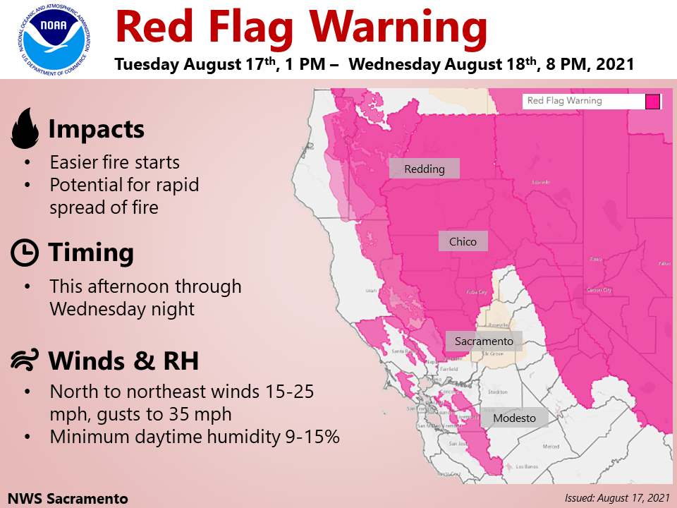
Red Flag Warning issued Tuesday evening through Wednesday across much of the Sacramento Valley, foothill and mountain terrain. Critical fire weather concerns through Wednesday due to breezy winds and low humidities.
Discussion
Increased onshore flow today cleared out much of the smoke that was blanketing the Sacramento Metro region. As of 3:00 am this morning, the Delta Breeze has been holding strong for the last few hours at about 30 mph and has helped improve surface conditions for Delta influenced areas. However, many locations across interior Northern California, particularly areas close to wildfires are still dealing with lingering smoke and haze.
Smoke and haze will likely continue to impact the region as wildfires continue to burn and emit smoke. Satellite imagery and radar analysis show ongoing fire activity at the Caldor Fire in El Dorado County overnight.
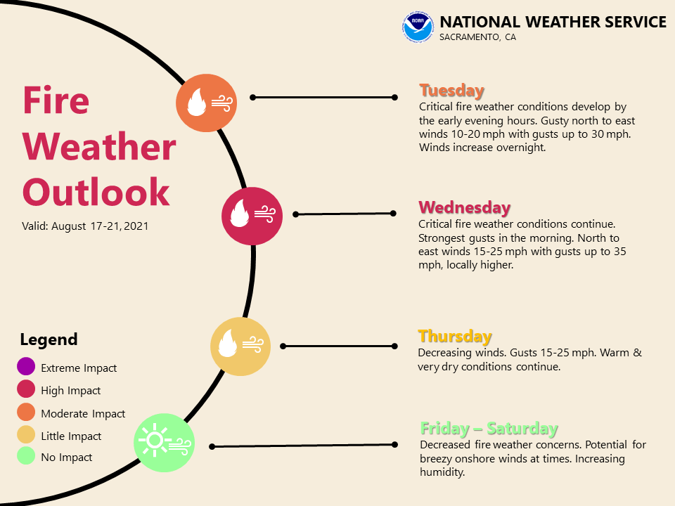
Temperature observations across Northern California as of 3:00 am this morning are coming in about 5 to 15 degrees cooler than this time yesterday morning. Temperatures today are also forecast to be notably cooler than yesterday with near normal highs expected. This change is due to a low pressure system forecast to impact our region today through Thursday.
Cooler temperatures as well as dry, gusty winds are expected. This synoptic pattern will likely bring critical fire weather to portions of California.
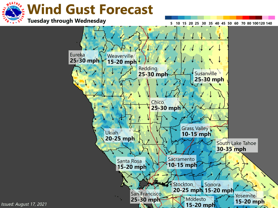
KSAC to RNO gradients are forecast to peak Wednesday morning at around 10 mb. Winds are forecast to shift out of the north to northeast as the low pushes south and east into the Great Basin. These northerly to northeasterly winds could transport smoke from regional wildfires into the Valley.
Extended Discussion (Saturday through Tuesday)
Ensemble guidance keeps the Northwestern US under general troughing into next week. Northwesterly to westerly flow will help keep temperatures closer to climatological normals for this time of year. Under this general pattern, we could also see breezy conditions at times.