Locally breezy and dry with fire weather concerns persisting. Near normal temperatures and dry conditions through the weekend into next week. Red Flag Warning in effect until 11:00 am in the Foothills, 8:00 pm in the Valley.
Discussion
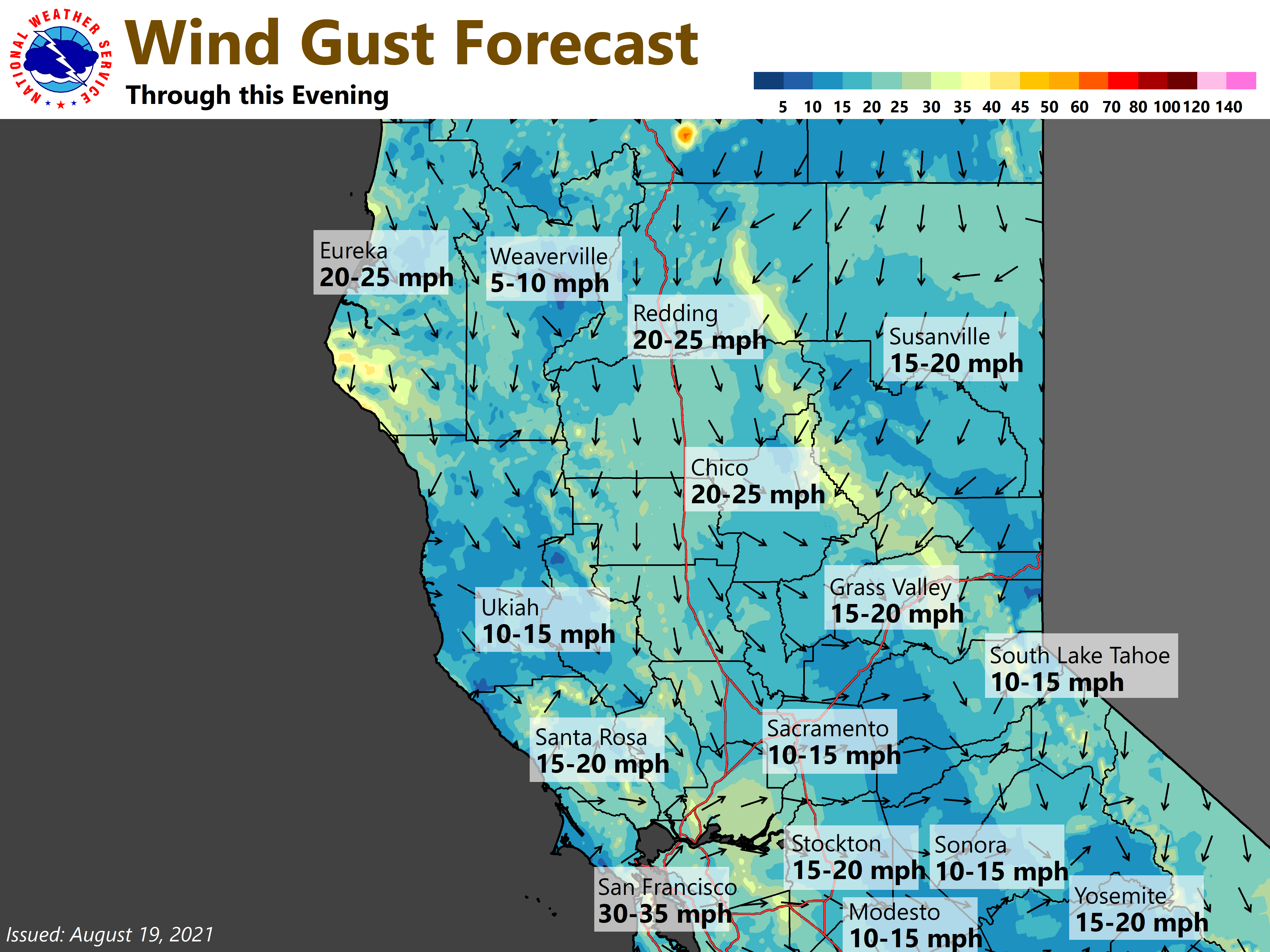
The closed low to the east of NorCal is presently centered near the NV/ID/UT border. We remain on the backside of this system with subsidence and clear skies overhead (except for the wildfire smoke). Surface high pressure has rolled over into the Great Basin, and the RNO-SAC gradient has tightened to around 5 mbs while the MFR-SAC gradient has slackened to about 7 mbs (down from around 11 mbs 24 hours ago). Northerly wind gusts are currently mainly in the teens to low 20s mph along the western edge of the Sacramento Valley, while some local northeast gusts of 25-35 mph are present across the higher elevations of the northern Sierra and near southwest facing canyons in Butte County.

North/northeast surface gradient forecast to continue slackening today across most of the area. The gusty winds over the southern Cascades and northern Sierra are expected to drop off late this morning, and the Red Flag Warning for that area is scheduled to expire at 11 AM. Breeziness likely to be mainly confined to the Sacramento Valley this afternoon where the Red Flag Warning is in effect until this evening.
Lighter winds expected across the region Friday, then another trough is forecast to brush by to the north on Saturday. We’ll have to keep an eye on this one too since the current trough looked to take a similar track before digging further south and bringing stronger winds to NorCal.
Not much overall change in temperatures expected today and Friday, and readings will continue to heavily dependent on the amount of smoke. Around 5-10 degrees cooler temperatures are possible over the weekend as the trough passes.
Extended Discussion (Monday through Thursday)
Ensemble guidance is in good agreement that weak troughing will be seen early next week allowing for seasonable temperatures and onshore winds. Around mid-week clusters indicate weak ridging may take over allowing for a slight warming trend. As mentioned before, smoke will continue to impact day to day highs. Dry weather continues.