Warm and dry conditions with periods of breezy winds. Gusty north winds Thursday and Friday will bring elevated fire weather concerns. The National Weather Service in Sacramento has issued a Fire Weather Watch, which is in effect from Thursday morning through Friday evening.

Discussion
Clear skies cover the region early this morning, and IR difference imagery shows the marine layer cloudiness has been mostly mixed out along the coast. Onshore surface pressure gradient has slackened compared to 24 hours ago, but enough residual gradient remains for locally breezy winds through the Delta. Current temperatures are mostly in the 50s through the Central Valley, except for lower to mid 60s across the northern half of the Sacramento Valley.
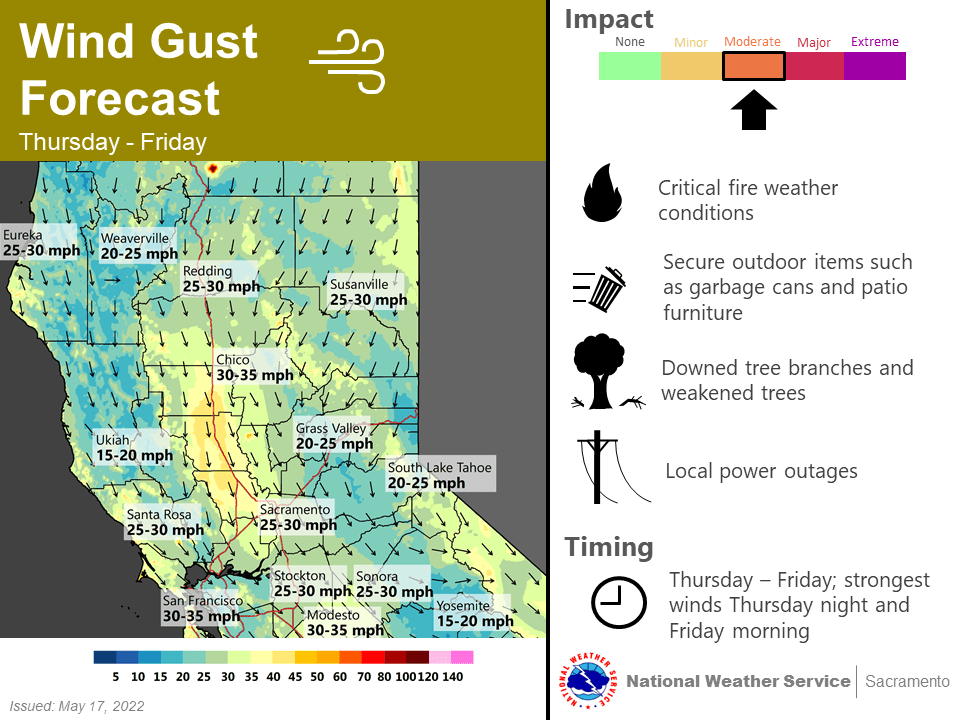
Main forecast concern the next several days remains centered on the north wind event that develops over NorCal late this week behind the trough moving into the Great Basin. Confidence is increasing that we’ll see an extended period of breezy north winds through much of the Sacramento Valley Thursday and Friday, with northeast winds across the northern Sierra Thursday night into Saturday. Gusts of 30-40 mph will be common.

The wind combined with very low RH and drying fuels will result in elevated fire weather conditions. Otherwise, warming returns today and Wednesday with slackening onshore flow and short-wave ridging building ahead of the trough. Highs will be back into the 90s across most of the Central Valley.
Milder overnight lows are also expected, particularly in the thermal belts. Widespread lows in the 60s are forecast through the valley on Wednesday night as northerly flow picks up. About 5-10 degrees of cooling (compared to Wednesday’s highs) are expected with the trough passage on Thursday and Friday.
Extended Discussion (Saturday through Tuesday)
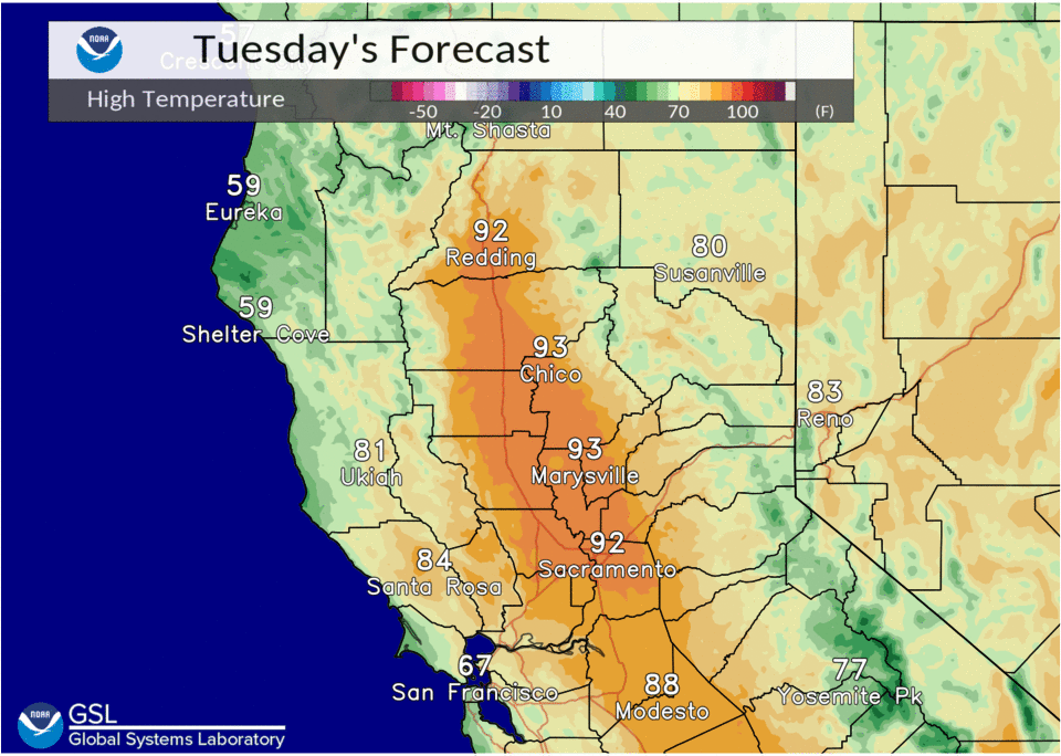
Ensembles and clusters show ridging as the main feature for interior NorCal in the extended. As such, dry weather and above normal temperatures will prevail this weekend into early next week. Widespread 90s are expected in the Valley, with some locations coming close to the 100 degree mark early next week.
Latest ECMWF EFI shows the highest temperature anomalies over portions of the Central Valley for Monday. The heat risk may run in the moderate category, impacting groups that are sensitive to the heat.