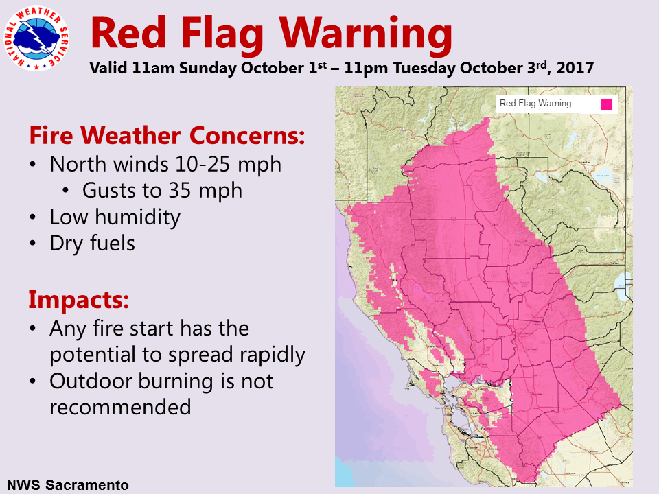
October 1, 2017 – High pressure building inland will result in gusty northerly wind over interior Northern California into early this week. A Wind Advisory is in effect through Monday evening. The combination of wind and low daytime humidity will lead to a period of high potential for rapidly spreading fires. Humidity is expected to change little Monday and Tuesday, then increase Wednesday, along with lighter winds. Cooler weather with breezy north winds into next week. Precipitation chances will likely remain north of the area.
Discussion
Other than some high clouds streaming down in northwest flow, skies are clear across interior NorCal early this morning. Current temperatures range from the 30s in the mountain valleys to the mid 50s to mid 60s across the Central Valley.
Northerly surface pressure gradients continue to tighten, and the MFR-SAC gradient is now up to 10 mbs. Northerly breezes are beginning to show up in the Sacramento Valley with several stations reporting gusts approaching 20 mph.
Dry and breezy/windy conditions will continue into Monday with slightly cooler temperatures, then milder and less breezy heading into mid-week. Current headlines on track.
Extended discussion (Thursday through Sunday)
Upper level disturbance over the west will bring cooler than average conditions to start the long term forecast period on Thursday with temperatures slightly below normal for early October. Temperatures will slowly increase to above normal heading into next weekend. Although there is a remote chance for a stray mountain shower, the weather pattern is expected to be dry with mostly clear skies across interior northern California. Breezy conditions are expected each afternoon from mid to late week as the pressure gradient across the valley strengthens between the high pressure in the Pacific and the low pressure in the valley.