October 25, 2016 – Wet and unsettled weather will occur this week as several weather systems transit the area.
Discussion
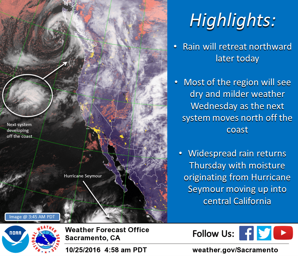
Weakening cold front has stalled out across the northern third of California with showers continuing from the Bay Area up through the Sacramento region into the northern Sierra. Rainfall amounts over the past 24 hours have varied from a few hundredths of an inch in the Sacramento area to over an inch at the north end of the Sacramento Valley, while much of the Feather River Basin has seen around 2 to 3 inches. Temperatures are mild ranging from the 40s in the mountains to the 50s to mid 60s elsewhere.
As the next system develops off the coast, the weakened cold front will lift back to the north today and be absorbed as a warm front resulting in generally lighter amounts of precipitation by this afternoon. Precipitation is expected to retreat further to the north and west tonight, with most of the area seeing a return to drier weather Wednesday into early Thursday.
Another wet system is forecast to bring more widespread rain on Thursday and Thursday night – perhaps a short break on Friday – then another system Friday night. Snow levels will remain high with accumulating snowfall expected to be limited to just the highest peaks.
Extended discussion (Saturday through Tuesday)
Active weather pattern will continue for much of the extended period. Models in general agreement although vary just a bit in timing of each wave and precip amounts.
Friday’s wave will begin to shift east on Saturday with a few showers lingering across higher terrain and portions of the area.
Another wave will move onshore from the Pacific on Sunday into early Monday. This wave could be fairly wet, with snow levels lowering below major pass levels during the day. This will be something to watch going forward as it may impact travel over the mountains Sunday.
Brunt of storm will shift east on Monday with showers lingering across higher terrain. Looks like a decent probability that active pattern will continue past Monday. GFS suggests additional systems every 1-2 days between brief ridging while ECMWF not quite as robust. Below normal temperatures will rule through the period.