Dangerous heat will persist through the end of the week. Monsoon moisture will bring a slight chance of thunderstorms to the northern Sierra Nevada. A more significant moisture surge is possible over the weekend into early next week.
Discussion
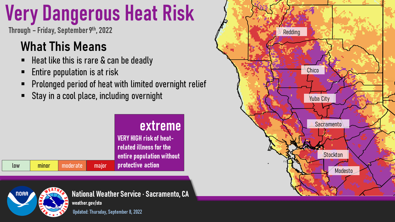
Dangerous heat will continue today with record heat continuing. Although we have been trending cooler this morning northerly winds today will help to increase temperatures up to record levels today with highs near or slightly above Wednesday’s highs.
There are hints that some low clouds may start to return to the Bay Area by Friday morning that will help to cool Friday mornings lows to more comfortable levels.
Temperatures will still be very warm for this time of year at 10 to 15 degrees above seasonal norms. That will lead to a slight cooling trend for Friday but temperatures are still expected to be at or near record levels.

Smoke will be an issue over the mountains and foothills mainly from around Placer county southward the next couple of days.
Isolated showers or thunderstorms will be possible today and Friday mainly south of Alpine county. Friday night we are looking at the return of the Delta Breeze which should be at least of moderate strength Friday night so expect a faster cool down Friday evening.
Moisture from current hurricane Kay will spread clouds over the region Saturday helping to bring significant cooling over this weeks temperatures with highs expected in the upper 80s to upper 90s in the valley. This will also bring a chance of showers and thunderstorms this weekend to the mountains but at this time seems limited to the Sierra Nevada.

A decent trough of low pressure off the coast this weekend will also help to bring synoptic cooling to the region as well with temperatures on Sunday expected to be mainly in the 80s for the valley.
Extended Discussion (Monday through Thursday)
Long wave trough resides off the West Coast through the extended forecast period as a series of short waves move inland. Increased onshore flow and synoptic cooling will result in below normal high temperatures after Monday. Slight chance of afternoon showers and thunderstorms will continue over the Sierra Nevada Monday through Wednesday.