Dry conditions are forecast to continue with very hot temperatures expected by the end of the week continuing into early next week. An Excessive Heat Watch is in effect for much of interior NorCal Friday afternoon through Monday evening when the hottest weather is expected.

Discussion
Clear skies cover the region early this morning. Onshore surface pressure gradients remain about the same as 24 hours ago, but the marine layer is a bit more shallow. That combined with wider temp/ dew point spreads across the southern Sacramento Valley make it unlikely that we’ll see a repeat of stratus extending inland again this morning.
Temperatures will warm a bit across the region today as the low moves by to the north through the PacNW and modified marine influence begins to wane inland.
Beginning Thursday, ensembles continue to indicate high confidence in the Southwest high strengthening and building westward into NorCal bringing another heatwave that will last through the weekend into next week. This will lead to a warming trend as subsidence increases and marine influence further wanes. Triple digit heat will expand across the lower elevations with milder overnight low temperatures resulting in widespread high to very high heat risk by Friday.
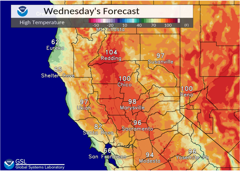
Ensembles indicate that surface thermal trough is likely to remain over the Central Valley, or to the east, through the weekend which would allow for a trickle of onshore flow into much of the valley likely taking the worst case temperature scenarios off the table for those areas. Nevertheless, the north end of the Sacramento Valley will likely see very hot temperatures again over the weekend with highs in the 110-115 degree range approaching daily records for Redding and Red Bluff.
It still appears that some elevated moisture/instability will work its way into NorCal later Thursday into Friday, but deep convection will likely be capped by warmer mid-level temps associated with the building ridge.

Extended Discussion (Sunday through Wednesday)
Desert SW upper high continues to be the main synoptic feature influencing weather over interior NorCal through the extended forecast period. This will result in dry conditions with well above normal daytime temperatures. Widespread triple digit highs forecast throughout the Central Valley Sunday with potential record heat. High temperatures forecast to trend down early next with increasing Delta flow.