Widespread triple digit heat expected for the lower elevations into the weekend. High to very high heat risk is expected with well above normal temperatures. Excessive Heat Warning from 2 PM this afternoon to 9 PM PDT Saturday.

Discussion
Other than some high clouds arcing northward from central California, skies are clear across the region early this morning. Surface pressure gradients have reversed to offshore, or weakened onshore. Temperatures are mostly higher compared to 24 hours ago with only the mountain valleys seeing cooler readings under a much drier airmass and lighter winds. Current temperatures vary from the upper 30s in the colder mountain valleys, to the upper 50s and 60s across most of the Central Valley (Redding is currently in the mid 70s with a breezy north wind).
The Four Corners high is expanding westward and will bring much hotter weather to the region today into the weekend. Highs today will mostly range from 100-105 across the Central Valley. It still looks like the hottest days will be Thursday and Friday when highs through most of the valley will be around 110 degrees. Additionally, overnight lows will be very mild beginning tonight with upper 60s to around 80 common in the valley and foothill/mountain thermal belts. The result will be widespread high to very high heat risk. Heat safety precautions should be enacted!

Some weakening of the ridge by the weekend may allow at least a shallow marine layer to make a comeback, and the resultant return of a weak to moderate Delta Breeze should gradually take the edge off the high heat.
Another feature to keep an eye on the next few days is the rapid spread of high-level moisture westward from Baja and northern Mexico around the southern periphery of the expanding high. IR imagery has been showing occasional enhancement, along with a few lightning strikes, well to the south and southwest of San Diego. Models indicate some of this moisture will brush the southeast corner of the forecast area later Thursday into Friday. At this point elevated instability appears to be pretty meager, but I wouldn’t be too surprised to see some virga around the area Friday morning. Thunderstorm chances will likely be east of the northern Sierra crest.
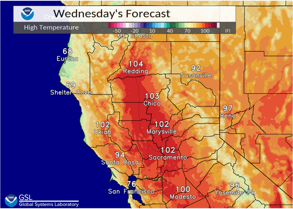
Extended discussion (Sunday through Wednesday)
Strong upper ridging responsible for our heat wave weakens Sunday and shifts into the Great Basin early next week as upper low develops off the CA coast. This will result in a cooling trend through the extended forecast period. Triple digit heat continues through much of the Central Valley Sunday, then 90s are forecast Monday with triple digit heat lingering in the Northern Sacramento Valley. Highs by midweek return to near normal with 80s to 90s for the interior with 60s to lower 80s for the mountains and foothills.