August 25, 2016 – Dry weather pattern with near normal temperatures for the rest of the week.
Short term discussion (Today through Sunday)
A short wave currently over southern Oregon, which is evident in water vapor imagery, will be dropping south and east into Nevada today. Considering moisture is limited and the forcing from this wave is weak, we are not expecting any thunderstorm activity.
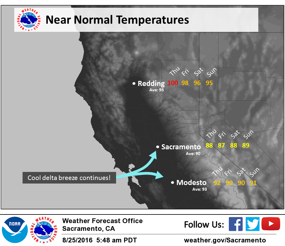
Currently, the marine layer is around 1500 ft deep which is similar to where it was 24 hours ago. This, combined with the moderate/strong onshore gradient will continue to bring slightly below normal temperatures for the delta and adjacent areas. Locations farther away from the delta breeze, such as the Northern Sacramento Valley, will be up to 5 degrees above normal.
Friday looks to be very similar to today with the exception of weak instability along the Sierra Crest in Tuolumne County. Ingredients for a weak isolated thunderstorm look marginal at best. Because of this, only expect a slight chance (<15%) of activity in Tuolumne County and southward. Beyond this, dry weather will prevail with sunny skies. A weak longwave ridge will build in Saturday and Sunday but will have relatively little influence on our temperatures.
Extended discussion (Monday through Thursday)
Model differences continue through the extended period. GFS brings a stronger minor wave through NorCal first part of next week followed by deeper main trough midweek. ECMWF is slower with progression of minor wave and tracks a more southern track with it. Main upper trough impacts the area through midweek. All solutions have limited available moisture and forecast looks dry through the period. Near normal temperatures Monday cool to slightly below normal through Thursday.