March 27, 2017 – Weather system exits the region today with dry and milder weather expected for NorCal much of the week. Another system will brush through the region Thursday with a few showers.
Discussion
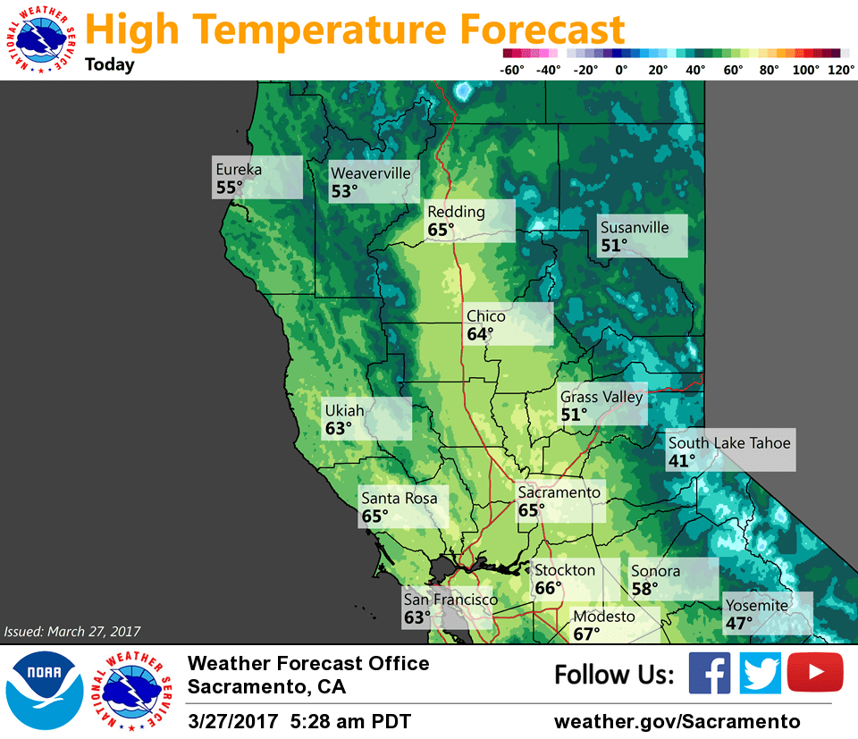
Radar shows some lingering showers over the northern Sierra from about Butte/Plumas Counties southward while much of the valley has cleared out. Temperatures are a little cooler compared to 24 hours ago and generally range from the upper 20s and 30s in the mountains to the 40s and lower 50s elsewhere.
Most remaining showers expected to taper off early this morning over the Sierra as the main upper trough shifts east. However, high-res models indicate a few may linger into this afternoon as a last batch of energy (presently along the Oregon coast) shifts southeastward along the backside of the exiting trough. While some residual travel impacts may linger this morning, most precip will end and the remaining winter weather advisories were dropped at 5 AM.
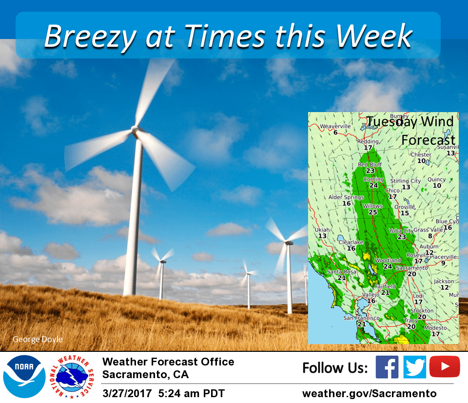
Upper ridging along with northerly flow will then bring warming and drying to interior NorCal into mid-week. Northerly winds will be breezy at times the next several days across the Central Valley.
High temperatures will return to around average by Tuesday, then warm about 5 more degrees on Wednesday.
Another fast moving weather system is forecast to clip the area later Wednesday into Thursday. Most showers with this one are expected over the mountains. It will bring cooler temperatures for Thursday along with another round of breezy north winds as it too moves to the east.
Extended discussion (Friday through Monday)
Dry weather returns to the region on Friday as the closed upper low shifts eastward. An “inside slider” pattern is likely to develop, hinting at breezy north winds across interior Northern California.
High pressure builds across California next weekend, bringing a strong but relatively brief warming trend. Temperatures will be on the order of 10 degrees warmer than normal in this timeframe.
Longer-range models diverge early next week. The GFS & GEM both hint at some flavor of low pressure system moving through the region, whereas the ECMWF maintains a stronger ridge. With a high degree of uncertainty, our forecast reflects a blend of the various solutions.