March 2, 2017 – Dry weather with a warming trend continues through Friday. A wetter and colder pattern returns this weekend into next week, bringing winter travel concerns. Flooding concerns continue as runoff from recent rain continues to work its way downstream, adding stress to waterways.
Discussion
High pressure and clear skies cover the region. Temperatures are little milder compared to 24 hours ago and generally range from the teens and 20s in the mountain valleys to the mid 30s to mid 40s elsewhere.
Little change expected today and Friday as dry and mild weather continues across the region. Most locations will see a little warming, however the north end of the Sacramento Valley may cool slightly due to lighter winds.
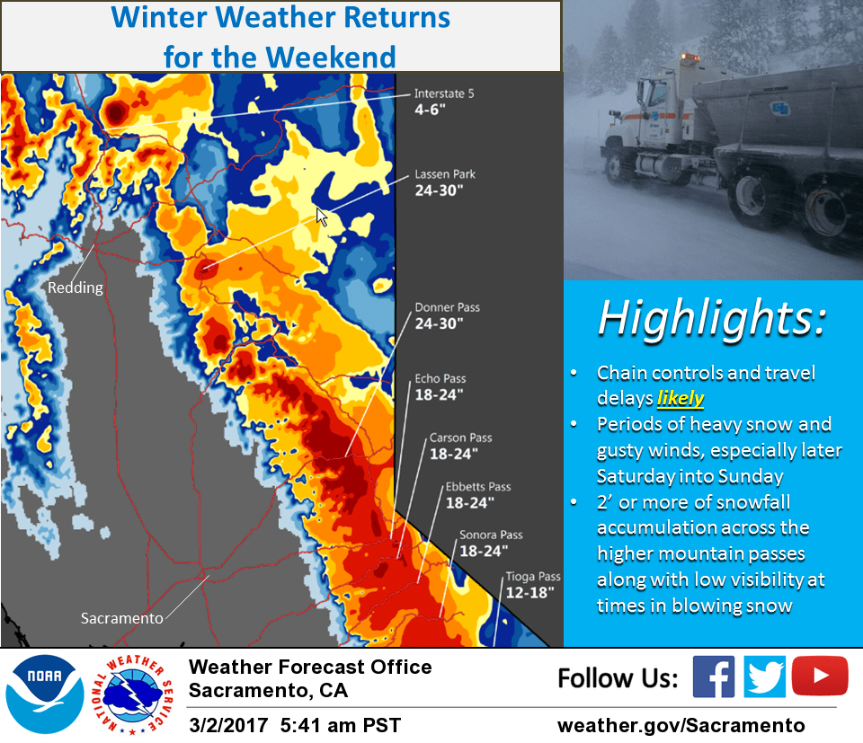
By Friday night, a Pacific storm will approach NorCal bringing a slight chance of some precipitation spreading into the northern mountains. The heaviest precipitation is expected Saturday night into early Sunday as the system moves inland.
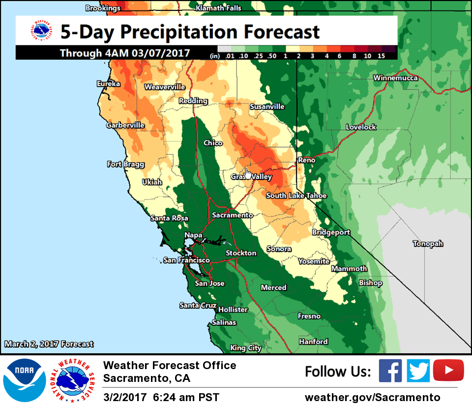
This system has a relatively weak moisture plume and is rather quick moving, so is not expected to be an especially wet system. Rain amounts in the mountains are forecast to be 1.5 to 2.5 inches, and much of this will be in the form of snow. Early storm total snow estimates through the weekend are a foot of snow above 5000 feet, potentially 2 feet at pass levels. With much of the precipitation in the form of snow, runoff is expected to be limited.
In addition to precipitation, breezy to windy conditions are expected this weekend, especially Saturday night.
Extended discussion (Monday through Thursday)
Model differences continue into the extended period. ECMWF and GEM models both put troughing over the Pacific northwest and Norcal although ECMWF somewhat deeper. GFS builds an upper ridge over the eastern Pacific limiting precipitation to far northern California. ECMWF shows a fairly tight southerly surface wind gradient over NorCal so could see breezy winds Monday. For now have used blended model approach leaning towards the more middle of the road GEM model.
ECMWF remains wettest model going into Tuesday with zonal flow and another shortwave trough bringing precipitation chances to NorCal. Meanwhile GFS and GEM intensify ridging over the west coast for a drier solution. Have lifted precipitation chance line northward on Tuesday but confidence is still low due to poor model consistency.
All models show ridging over the west coast by Wednesday but ECMWF still flattest allowing a slight threat of light precipitation over Shasta county. All models show dry conditions over CWA Thursday under upper ridging. Daytime temperatures warm slowly through the extended period warming to a little above normal by mid week. Upper ridge will bring highs up to several degrees above normal on Thursday with highs reaching or topping 70 in the northern Sacramento valley.