March 1, 2017 – Flooding concerns continue as runoff from recent rain continues to work its way downstream adding stress to waterways. Dry weather with warming trend through the end of the week. Wet pattern returns this weekend into next week.
Discussion
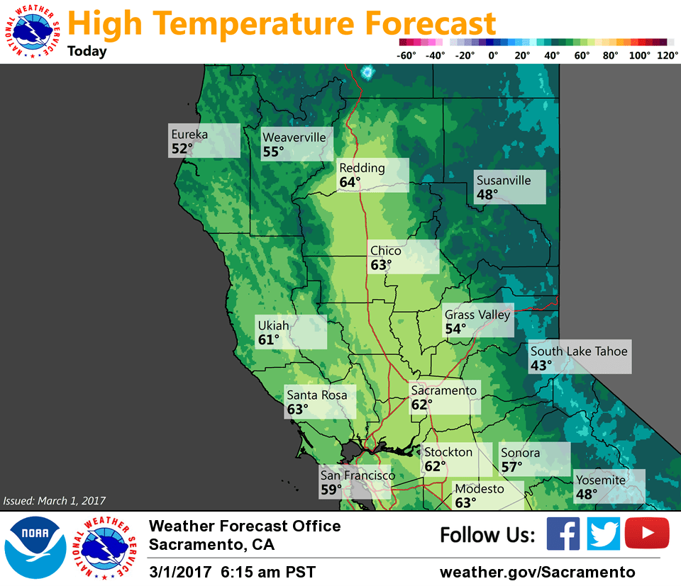
Clear skies across interior NorCal early this morning as ridging from the eastern Pacific builds into the region. Current temperatures range from the single digits in the mountain valleys to the 20s and 30s elsewhere in the mountains. Readings in the Central Valley are in the mid 30s to lower 40s. Some patchy frost will once again be possible around sunrise.
Dry weather with milder temperatures is expected through the end of the week. Precipitation chances return over the weekend as the ridge shifts east as a trough approaches from the Gulf of Alaska.
Extended discussion (Sunday through Wednesday)
Mid range models in good agreement in swinging a Pacific cold front through northern California early Sunday. Area of highest precipitation appears to be over the northern Sierra where good orographics squeeze out the most moisture. Fairly low snow levels will make for travel impacts over the Sierra Cascade range with several inches of snowfall currently forecast above about the 3000 to 4000 foot level. Frontal system shifts east of the state by Sunday evening with showers likely to continue through the night as the associated upper trough passes through the Pacific Northwest and northern California.
Model confidence decreases on Monday as models diverge on strength of weak upper ridge over the west coast. GEM model would indicate a fairly dry solution with a much flatter ridge solution of the GFS bringing precipitation to nearly the entire forecast area. Have compromised for now by putting in light precipitation north of about interstate 80.
Next Pacific frontal system is forecast to move through around Tuesday but model timing not showing a lot of consistency. ECMWF model the fastest bringing this system through Norcal Tuesday afternoon while the GEM and GFS hold off until Tuesday night and both have weaker solutions. Snow levels are a little higher with this system but still low enough to cause Sierra travel difficulties.
Model inconsistencies continue through the middle of next week with GFS and GEM showing a drier ridge solution and ECMWF showing a wetter trough solution. Have kept chance pops in for most of the CWA for now but confidence remains low until better model consistency is achieved. Daytime highs through the extended period remain a little below to near normal.