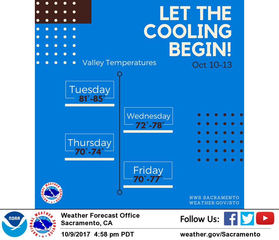
October 10, 2017 – Dry with temperatures around average for the remainder of the week. Storm systems passing north of the area will keep winds gusty at times through the week.
Discussion
Skies are clear other than a few high clouds passing overhead ahead of the approaching trough. Satellite imagery still showing significant heat emanating from the Atlas Fire burning along the Napa/Solano border to the west of Fairfield. Winds are much lighter and temperatures considerably cooler compared to 24 hours ago a surface gradients have relaxed, but the airmass remains very dry with dew points in the 20s and 30s.
Upper level trough swings through the PacNW today will brush close enough to NorCal to bring increased afternoon southwest wind gusts for the foothills and mountains. Gusts from 15 to 20 mph will be possible foothills and up to 30 mph over highest terrain during the late afternoon.
North winds will return to the Sacramento Valley Wednesday and Thursday with potential critical fire weather conditions. At this time sustained speeds from 15 to 20 mph look possible. Although, some increase in relative humidity may mitigate threat as temperatures fall 10 degrees or more versus early week readings.
Extended discussion (Saturday through Tuesday)
Upper ridging in the EPAC builds inland this weekend then flattens some early next week. Dry weather expected through the extended forecast period with near to slightly below normal temperatures.