January 16, 2017 – Dry through Tuesday, then a series of winter storms will begin Wednesday and continue into early next week.
Discussion
Amplified upper air pattern will continue dry weather across NorCal the next couple of days. Despite some high clouds spilling over the ridge, fog and stratus has redeveloped through much of the Central Valley as strong low-level inversions remain in place.
Current temperatures range from the teens and lower 20s in the colder mountain valleys to the upper 30s and lower 40s in the thermal belts along the periphery of the valley. Stratus covered portions of the Central Valley are in the upper 30s and lower 40s, while elsewhere through the valley readings are in the lower 30s.
Little change is expected today and Tuesday as dry weather continues as the ridge gradually flattens. The north end of the Sacramento Valley will continue to see mild temperatures with light northerly winds while areas from Sacramento southward will continue to fight the stratus with only a few hours of late-day sunshine expected leading to daytime highs only around 50.
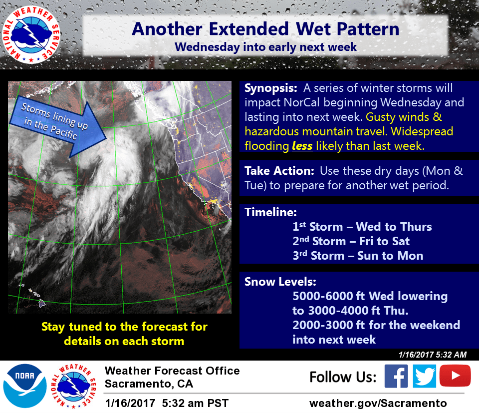
Over the past 24 hours, models have settled on Wednesday for the timing of the return of wet weather to NorCal. Wet and windy conditions will return by Wednesday afternoon and continue into early Thursday as the digging upper trough interacts with another plume of deeper moisture over the eastern Pacific. Up to 12 hours of moderate precipitation can be expected with 1/2 to 1 inch of rain in the valley and 1-3 inches in the foothills and mountains.
Snow levels with this initial system will generally range from 5000 to 7000 feet Wednesday, then lower quickly to 3500-4500 feet by early Thursday. A foot or more of snow will be possible for the mid and upper slopes of the northern Sierra.
Showery weather expected to continue Thursday, then another wet and windy system moves into the region Thursday night with lower snow levels (3-4K ft). This will be a fast moving system with QPF forecast to be a little lighter than the Wednesday one.
Main impacts from these first two storms this week are expected to be centered around gusty winds and mountain snow. Widespread flooding is not as likely as last week as snow-levels will be moderately low and duration of QPF relatively short.
Extended discussion (Friday through Monday)
Pacific frontal system moves through late Thursday through Friday with rain and mountain snow. Models showing decent precip totals with this system along strong wind and the potential for some snow into the foothills Friday night into Saturday. Scattered showers possible Saturday, tapering off Saturday night as weak upper ridging moves through. Another wet Pacific system progged to impact the area Sunday into Monday bringing more significant rain and wind along with relatively low elevation snow.