March 29, 2017 – Dry and milder weather expected for NorCal today. Another system will brush the region tonight through Thursday with a few showers. Dry and warmer weather returns for the weekend.
Discussion
Clear to partly cloudy skies cover the region early this morning as the transient ridge begins to give way to the approaching trough from the Gulf of Alaska. Current temperatures range from the mid 20s to mid 30s in the colder mountain valleys to the 40s and 50s elsewhere.
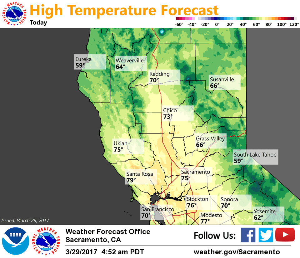
Today is expected to be another dry and mild day across most of the region, though clouds will be on the increase and a few showers may even pop up late in the day across the far northern portion of the state. The breezy northerly winds of the past couple of days will be history as flow begins to reverse ahead of the approaching system.
Tonight’s system will be a quick hitter giving interior NorCal a glancing blow as it quickly digs into the Great Basin on Thursday. Showers will be mainly confined to the northern mountains and northern Sierra Nevada, though the east side of the Central Valley may get a brief shower.
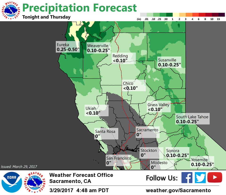
Despite the fairly decent moisture tap (TPW plume around an inch), the fast movement of the system will greatly limit the amount of QPF (mostly less than 1/4 inch in the mountains with a few hundredths of an inch in the valley) and snow accumulation in the northern Sierra (only a few inches expected).
Dry, cooler and breezy to windy weather can be expected on the backside of the system across interior NorCal for Thursday with only a few showers lingering along the northern Sierra crest into the afternoon. Wind gusts to 30 mph or higher can be expected in the Central Valley by the afternoon.
Ridging from the eastern Pacific forecast build across the region Friday and Saturday resulting in warmer temperatures. Breezy north winds will continue Friday, but should decrease somewhat by Saturday.
Extended discussion (Sunday through Wednesday)
Longer-range models are converging on a consensus that brings a shortwave trough NW to SE across the northern portions of the state. The GFS is considerably stronger with the system, but all solutions would suggest that most of the precipitation would be confined to the mountains Sunday, possibly into Monday. Breezy north winds are likely to redevelop behind this system, not unlike the wind episodes we’re seeing this week.
High pressure then rebuilds across Northern California early to mid next week, bringing another period of above normal temperatures. The GFS, ECMWF, and GEM are all hinting at a rather wet storm system moving toward the West Coast late next week.