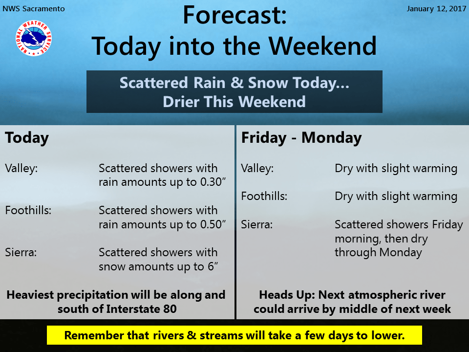
January 12, 2017 – One last system will bring relatively light rain to the lower elevations today with a few inches of snow over the Sierra. Dry conditions expected Friday afternoon through Monday. Next chance of precipitation next Tuesday with heavier precipitation possible the middle of next week.
Discussion
Upper low pressure system now centered over northwest California and expected to drop southward towards the Bay Area this afternoon. Most unstable region today expected to be south of interstate 80 and where most of today’s shower activity is likely.
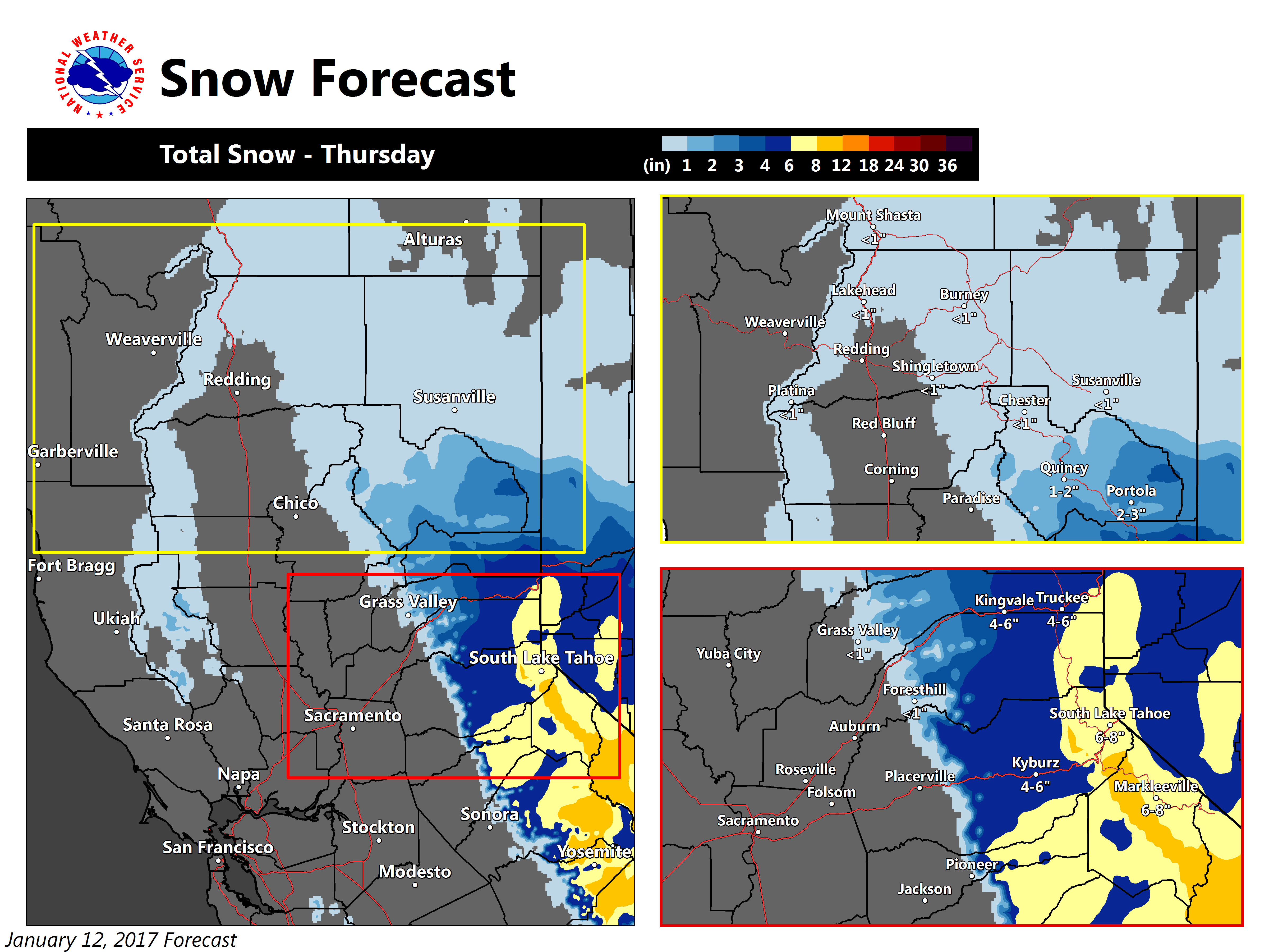
Compared to the last few days, overall precipitation should be fairly light but orographics will allow for several inches of snowfall over the Sierra today. Have kept winter storm warning up for northern Sierra today and will let it run for the southern Cascades through this morning to handle and scattered light showers as the low drops southward. Should not see a large change in snow levels today as the low drops southward and expected to run at about 3000 feet. Low continues southward tonight and early Friday bringing an end to showers across the CWA. Exception may be the northern Sierra where southeast flow aloft could bring wrap around moisture for a few light morning showers there.
Northerly flow will result in drier weather across the region late Friday into the weekend as ridging from the eastern Pacific extends into NorCal. Northerly flow will preclude widespread fog/stratus, so the most favorable area would be on the east side of the Valley and lower Sierra foothills. Daytime highs under this dry northerly flow should come in a little above normal for this time of year Friday through the weekend.
Extended discussion (Monday through Thursday)
Upper level ridging continues on Monday with fairly dry conditions and daytime highs ranging 2-7 degrees above normal. Models show the next storm heading into NorCal on Tuesday as another atmospheric river takes aim on California. Moisture will continue to stream into our region from Tuesday through midweek. This wet weather will bring additional rain and snow with snow levels lowering to around 4000 ft by Thursday.