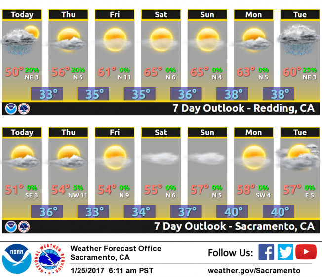
January 25, 2017 – Dry weather and morning fog into early next week outside of a few showers Thursday across northern portions of the state. Next cold, wet system impacts the region next Tuesday night into next Thursday.
Short Term Discussion (Today through Saturday)
Some high clouds spilling over the transitory ridge ahead of a weakening wave inbound Wednesday night into Thursday. Temperatures are dropping into the lower to mid 30s this morning within the Central Valley. Even with the very moisture (i.e. saturated) lower atmosphere, enough settling has occurred to enhance the dew/frost threat and diminish any significant fog threat.
A weak system will move through Wednesday night and Thursday and likely bring some showers over the mountains with a few isolated valley showers possible over the north. High pressure will build behind the low with some breezy northerly/northeasterly offshore winds Thursday night into early Saturday for the valley and Sierra Nevada, respectively.
The ridge axis moves overhead of NorCal and Nevada this weekend with lighter wind, setting up for a more significant fog/stratus event.
Extended discussion (Sunday through Wednesday)
Model consensus continues to advertise an influential upper level ridge of high pressure over northern California for Sunday and Monday. This feature will bring dry weather to the forecast area with near to slightly above normal temperatures. Clear skies at night will allow for the development of some overnight valley fog.
The next weather making system will arrive sometime Tuesday night into Wednesday as the upper level ridge breaks down ahead of an approaching upper level disturbance. Timing differences between model solutions are still prevalent, however the forecasts generally agree that precipitation across northern California is likely by mid week.