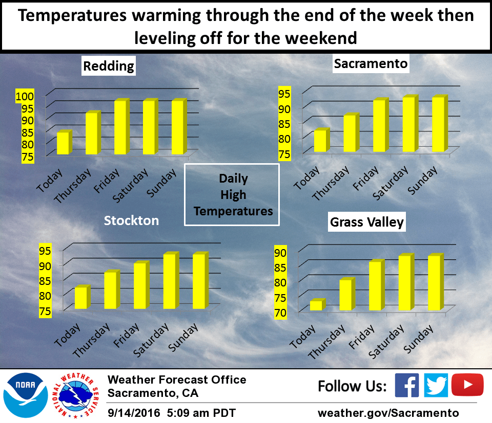
September 14, 2016 – Temperatures will be making a rapid warm up over the next couple of days as high pressure builds over the west coast. Temperatures will then level off over the weekend with daily high temperatures coming in a few to several degrees above normal.
Upper low pressure system over the eastern Great Basin continues to move eastward with high pressure building in over the west coast. Building high pressure is bringing clear skies to the forecast area and satellite fog product shows minimal stratus along the coast so not expecting stratus intrusion through the delta this morning. Overall airmass warms today so expecting a several degree warm up. We still have one more day of below normal temperatures today before even more airmass warming brings up daytime highs on Thursday to right around normal for this time of year. Daytime highs level off Friday and Saturday at a few to several degrees above normal as the main ridge axis shifts across the west coast. Subsidence under the ridge will bring continued fair skies through the short term period with generally light northerly winds most areas.
Extended discussion (Sunday through Wednesday)
High pressure over California will begin to flatten on Sunday. Models then begin to diverge next week. The GFS brings a shortwave trough through the region on Monday, while the Canadian model holds it off until Tuesday. The ECMWF is even slower, bringing the trough on Wednesday. Regardless of model solution, dry weather is likely to continue. Temperatures are expected to remain near or slightly above normal through the extended period.