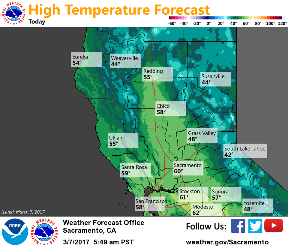
March 7, 2017 – Gradually milder weather through the end of the week with rain chances mainly retreating to the northern mountains and northern Sacramento Valley.
Discussion
Partly to mostly cloudy skies to the north of Sacramento early this morning while areas to the south are mostly clear. Just some very light showers lingering across the northern mountains. Temperatures vary from the teens and 20s in the mountains to the mid 30s to mid 40s elsewhere.
Gradually milder temperatures are forecast to return to the region the next several days as high pressure attempts to rebuild. Enough moisture is forecast to continue feeding in from the west- southwest, and terrain along with warm-advection may generate some light showers across the northern mountains and northern Sacramento Valley at times into Friday. Elsewhere, varying amounts of mid and high clouds are expected at times but it is expected to remain dry.
Extended discussion (Saturday through Tuesday)
Medium-range models have continued the recent trend of a strengthening eastern Pacific ridge pushing the storm track northward into the Pacific Northwest. As such, confidence has grown that most of our CWA will remain on the dry side Friday through the weekend, except for a slight chance of light showers along the northern periphery. This pattern would also allow for warmer temperatures across the region. It now appears that most Valley locations will see highs in the upper 60s to lower 70s in this timeframe, which would be a few degrees warmer than normal.
Both the ECMWF and GFS are in general agreement that a weak to moderate frontal system will bring the next chance of region-wide precipitation early next week.