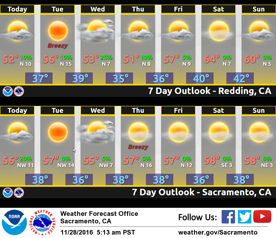
November 28, 2016 – Some lingering showers today, then dry weather with locally breezy north wind returns this week as high pressure builds along the West Coast. The exception will be a weak system that may bring a few showers to the mountains on Wednesday.
Discussion
Fast moving system exiting to our southeast early this morning. Showers are winding down across the valley to the north of Sacramento. Current temperatures are in the 30s in the mountains with mainly 40s elsewhere, pretty similar to 24 hours ago.
A few showers will persist over the mountains today as cyclonic flow and channeled vorticity on the backside of the trough continues over NorCal. The valley is expected to see an end to showers this morning.
Dry weather weather with seasonably cool temperatures expected for the remainder of the week as high pressure over the eastern Pacific dominates the pattern. The exception will be a weak system that is forecast to move through the ridge on Wednesday bringing a chance of showers to the mountains.
Northerly flow increases over NorCal tonight into Tuesday and will likely preclude much fog development. More north winds expected across the area on Thursday in the wake of Wednesday’s system.
Extended discussion (Friday through Monday)
Strong upper ridging forecast over Interior NorCal Friday through the weekend with dry weather and near to slightly above normal temperatures. Pacific storm moves through the PacNW late Sunday into Monday with southern portions of it possibly extending into far northern part of CWA. Models differ with depth and track of storm, and thus confidence is low. So for now, low POPs are advertised over mainly Shasta county during this period.