Warm and dry conditions today, then a cooling trend this weekend and early next week. Showers are possible over Northern California late Monday into Tuesday with best chances over the higher elevations north of I-80.

Discussion
Eastern Pacific high pressure has edged eastward over Northern California. This will continue the warm weather for another day, but with lighter winds, except some morning downslope breeziness through mountain canyons. Very warm high temperatures will be felt with afternoon highs generally from 95 to 100 degrees at Valley locations. These readings are about 10 degrees above normal for this time of year. NBM operational guidance was about 5 degrees too cool yesterday, so will use the 75 percentile today. Local areas of moderate heat risk impacts are possible across portions of the Southern Sacramento Valley and the Delta today and this could impact those who are sensitive to the heat.
Smoke from the Fawn wildfire just north of Redding will keep patchy areas of smoke over the northern Sacramento Valley this morning. South winds developing during the afternoon should help clear the smoke out.

Ensemble guidance indicates that ridge will flatten Saturday, as troughs begin to impact the Pacific Northwest. This will likely initiate a delta breeze with a cooling trend over the weekend. Temperatures are currently forecasted to fall into the upper 80’s to low 90’s Saturday and then 80’s Sunday and Monday.
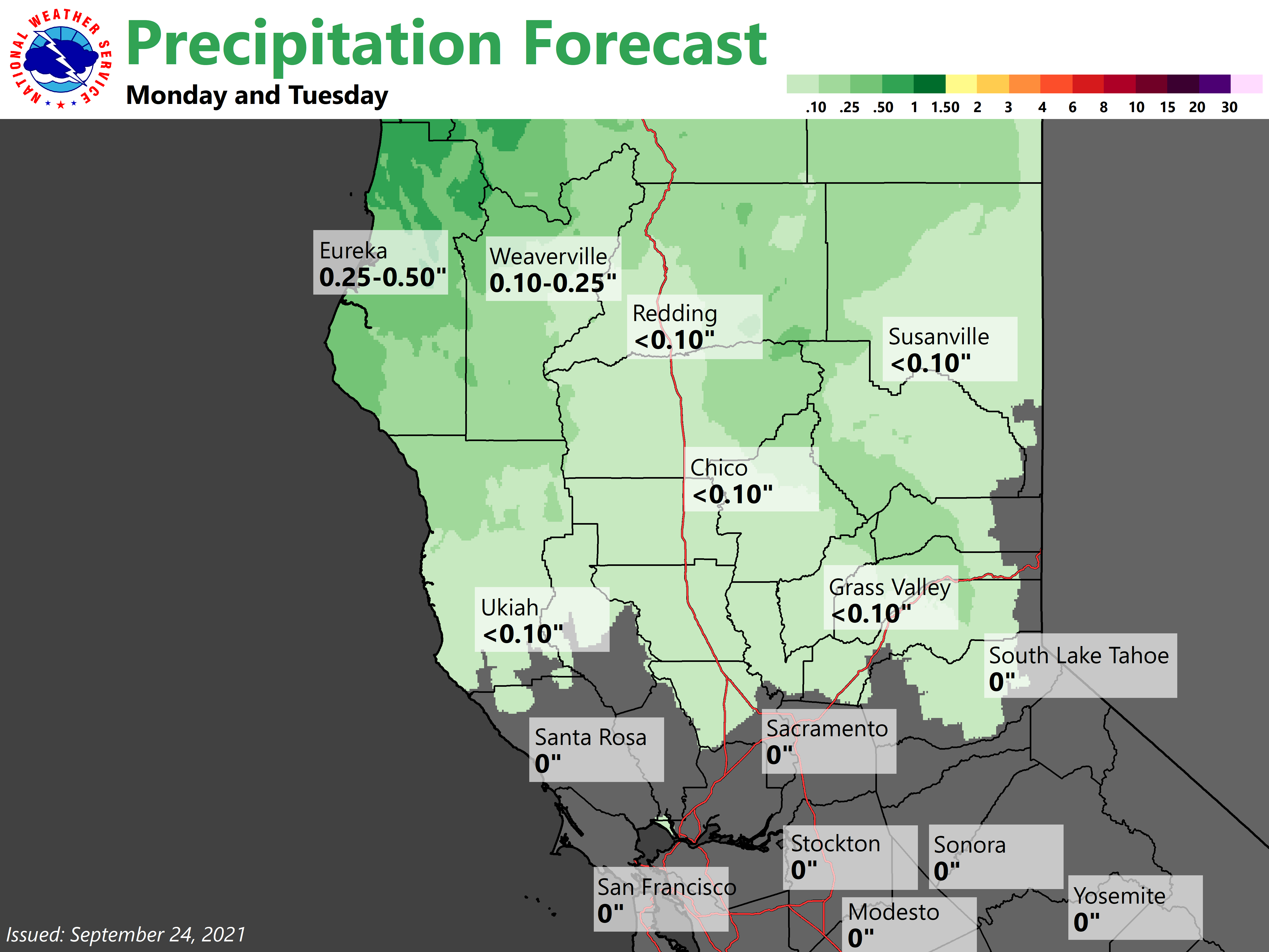
Larger trough will deepen over the Eastern Pacific Monday with showers spreading over the Coast Range through the day. Showers will then spread over much of the Northern Sacramento Valley and Sierra Monday night. Precipitation amounts look to be on the light side with Valley amounts generally less than 0.25 and mountain amounts less than 0.50 inches. A period of breezy ridgetop winds will be possible Sunday afternoon ahead of the trough.
Extended Discussion (Tuesday through Friday)
Cluster analysis continues to indicate a trough bringing unsettled weather to our region next week. Cooler temperatures upwards of 10 to 20 degrees below climatology are forecast across the region by Tuesday. Precipitation will be possible generally for far northern California with best chances over the higher elevations.
Current projections indicate this to be a low impact event overall with little precip expected to reach interior northern California. Breezy onshore winds will also be possible at times.