July 21, 2017 – Hot and dry weather today. Widespread triple heat across the valley this weekend. Slight chance of Sierra thunderstorms early next week. Excessive Heat Watch from late tonight through Sunday evening.
Discussion
Satellite imagery shows clear skies this morning, with dry southwest flow across interior NorCal. Temperatures are running 3 to 6 degrees warmer than 24 hours ago this morning. Some warming is expected on Friday with about 1 to 2 degrees of warming for the Sacramento region and up to about 5 degrees over the north end of the valley.
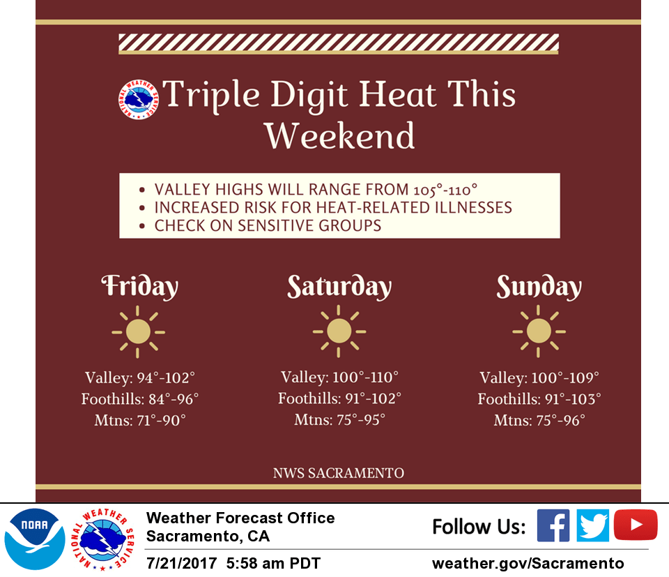
Hotter temperatures are expected this weekend as an ridging over the Four Corners extends into NorCal. As a result, daytime highs will be around 10 degrees above normal during this period, with valley highs ranging from 102-109. Thus, an excessive heat watch remains in effect Saturday-Sunday given the potential for heat- related illnesses over the northern Sacramento valley. Temperatures will cool down early next week as an upper trough approaches the area and the upper ridge shifts to the east.
Elevated instability and monsoonal moisture could lead to isolated late-day thunderstorm activity near the Sierra crest Sunday and Monday. However, most of the favorable conditions appear to remain outside of the forecast area.
Extended discussion (Tuesday through Friday)
Upper low off the Northwest CA coast will slowly move inland early next week. The GFS/GEM are a bit faster in this scenario than the ECMWF. Regardless, a chance of thunderstorms will be possible over the higher elevations with this system. This system will also bring a period of modestly cooler weather, though temperatures are likely to warm back up again by late next week after the system exits the region.