March 20, 2017 – A series of weather systems will bring cooler and more unsettled weather to the region this week.
Discussion
Mostly cloudy skies cover the region early this morning and temperatures remain on the mild side. Current readings range from the 30s and 40s in the mountains to the 50s elsewhere.
Trend back toward cooler and more unsettled weather for interior NorCal is underway. However, it will continue to be a slow process as the ridge is gradually nudged eastward by the approaching eastern Pacific trough. Deeper moisture will continue to feed up from the southwest today resulting in plenty of clouds, but weak lift associated with warm-advection will generate some sprinkles or light showers.
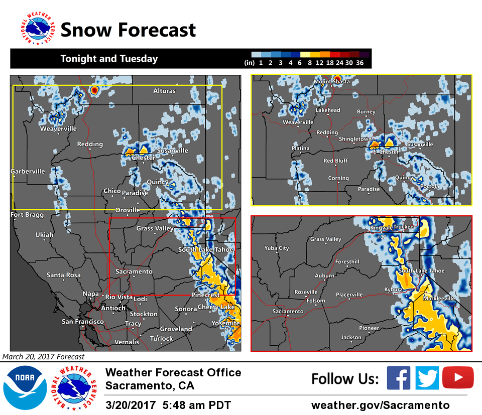
More substantial precipitation is expected to begin this evening into overnight and continue Tuesday as the frontal system finally works its way inland. Winds will also pick up across the region.
Snow impacts may develop across the higher passes over the northern Sierra late tonight and continue Tuesday as snow levels lower, so a winter weather advisory has been issued. Steepening lapse rates may lead to some heavy snow at times through the passes Tuesday afternoon and evening.
Potential for scattered thunderstorms is continuing to look favorable for Tuesday afternoon in the Central Valley as frontal precip clears the valley in the morning allowing for increased surface heating as the mid/upper level dry slot moves in ahead of the upper trough as it becomes negatively tilted. Steepening lapse rates above the warm and moist boundary layer yield some impressive CAPE (500-1000 j/kg) in the afternoon, and sufficient shear and cold temps aloft for significant hail potential. We’ll continue to monitor.
Trough lingers through Wednesday with continued threat for showers and perhaps a few afternoon thunderstorms. Short-wave ridging expected to result in dry weather across much of the region Thursday ahead of the next approaching system for late-week.
Extended discussion (Friday through Monday)
Models continue to advertise another longer wave trough dropping southward across northern California to continue a stormy pattern for Friday and into next weekend. The GFS and ECMWF are in general agreement to timing and progression of the system, and moderate to heavy rainfall at times can be expected.
Snow levels should be around 4000 feet, and heavy snow could occur Friday into Saturday morning. Travel impacts for the mountains could involve delays and chain controls. The cool air mass associated with the trough is anticipated to bring cool temperatures ranging between 5 and 10 degrees across the forecast area with highs in the mid to upper 50s for the valley.
Temperatures will gradually warm on Saturday but will drop again slightly Sunday as another atmospheric wave dives southward and through the region. Light rain for the valley and snow for the mountains could continue into next weekend.