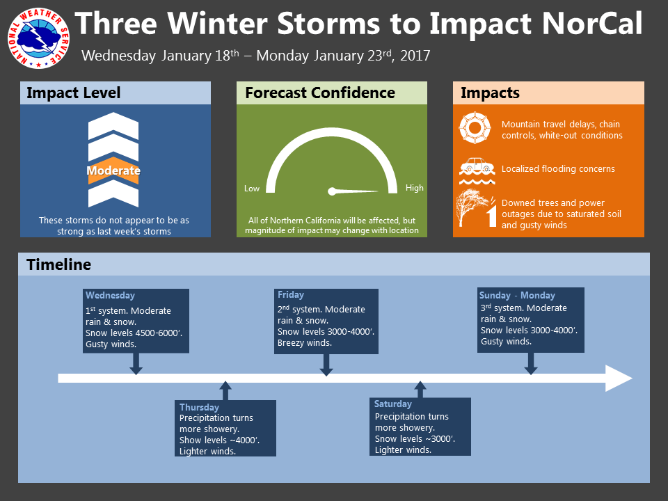
January 18, 2017 – First in series of winter storms moves through today with another Friday and a third around Sunday. Higher elevation travel impacts are likely due to snow and winds today and Thursday with lower snow levels for the Friday and Sunday storms. Moderate to heavy rain at the lower elevations with windy conditions today through this evening and again on Sunday.
Wind Advisory from 4 PM this afternoon to midnight PST tonight
Discussion
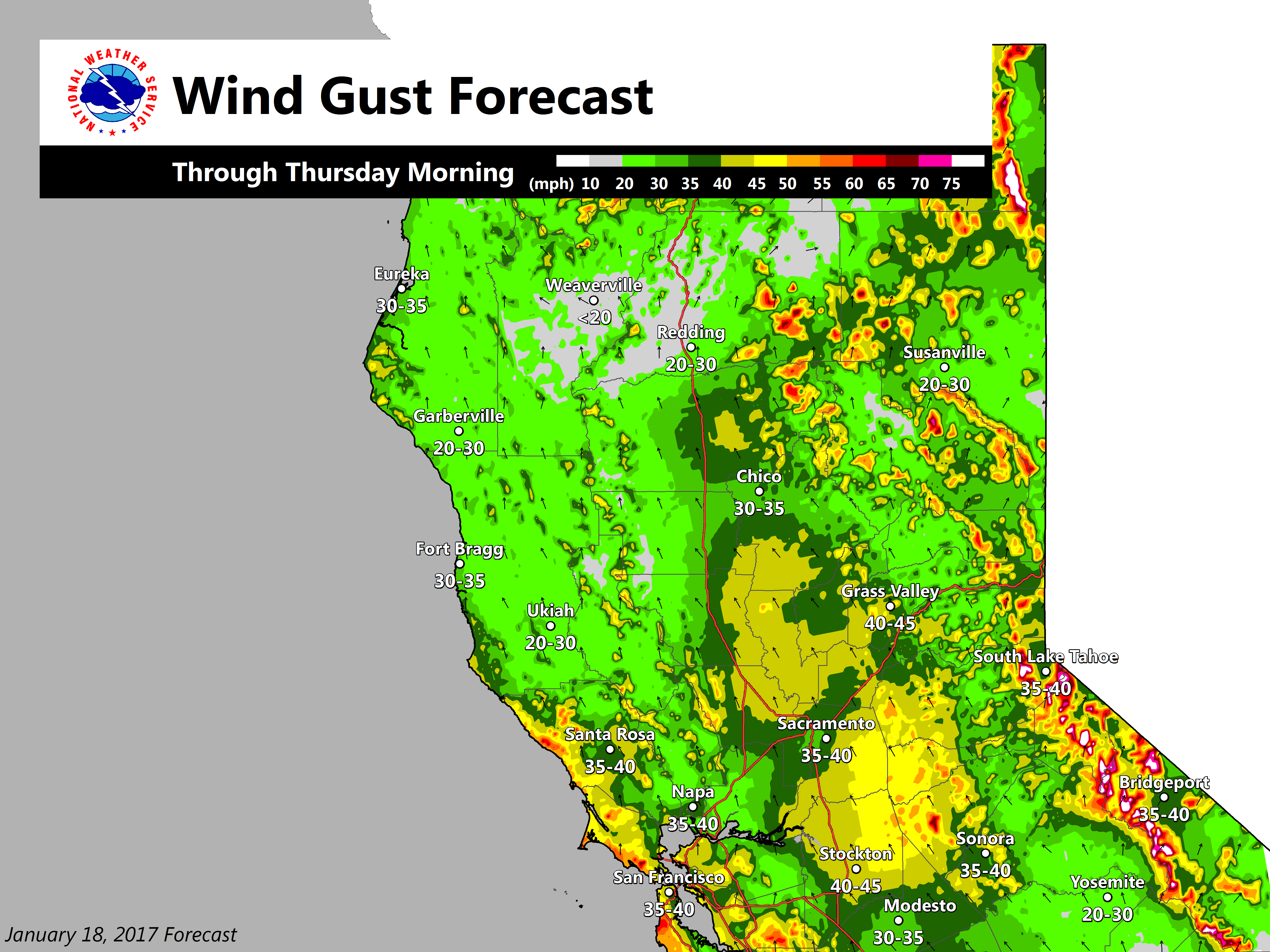
The first in a series of Pacific storm systems is now moving on to the north coast with a band of warm sector precipitation now moving through the central valley. So far, precipitation has been very light and expect it to remain that way until main frontal band moves through later this afternoon and evening. Cloud cover associated with the light warm frontal precipitation has not kept light fog from forming throughout the central valley this morning but should be enough to keep it from becoming significantly dense. Precipitation and winds will increase this afternoon as the Pacific front pushes inland with strong enough winds likely to warrant wind advisory now in place. Snow picks up this afternoon as well over the Sierra Cascade range.
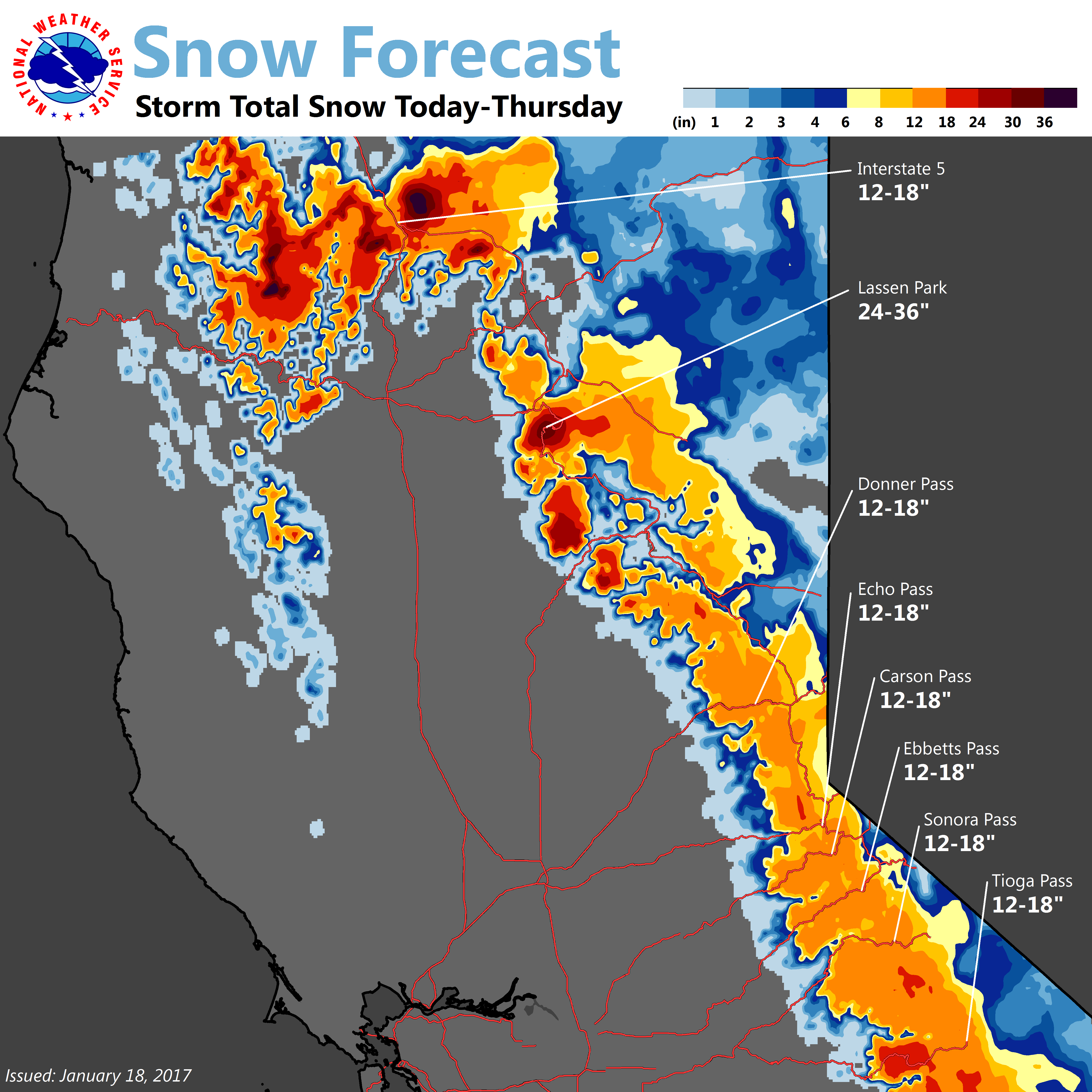
Snow levels over the Sierra will drop from around 5500 feet today to 4500 feet this evening and tonight allowing for significant impacts to trans-Sierra travel, especially when combined with the strong winds. Over the northern mountains. with snow levels remaining generally above 3500 feet, impacts there will be minimal although areas above 3000 feet may receive an inch or two of snow this evening when snow levels are lowest. The frontal band is forecast by models to move into the Sierra late tonight continuing the precipitation there while winds and precipitation decrease elsewhere. Showers continue on Thursday under flat ridging before next Pacific storm system moves onto the coast Friday morning.
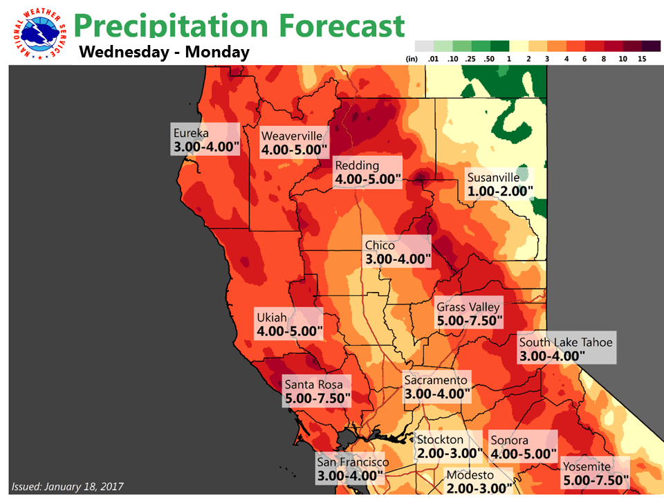
This next system will slide across Norcal on Friday bringing another round of rain, mountain snow and winds. A look at current QPF forecasts indicates that this will not be as wet of a storm as todays system with rainfall amounts about half to three quarter as much as todays system. Winds will be a little less as well. One significant difference with this system will be snow levels which are expected to drop below 3000 feet over Shasta county and below 3500 to 4000 feet over the Sierra Cascade range making mountain impacts more widespread. Saturday looks like a showery day under brief flat ridging before next system arrives at the coast Saturday night.
Cloudy cool conditions throughout the short term forecast will keep daytime temperatures a little below normal with overnight lows a bit above.
Extended discussion (Sunday through Wednesday)
Precipitation spreads across the entire forecast area Saturday night into Sunday as next Pacific frontal system impacts interior NorCal. Models have trended down some on QPF and now suggesting upwards of 1 to 2.5 inches in the Central Valley and foothills and upwards of 3 to 4 inches in wetter mountain locations. Snow possible down into the foothills with this system and several feet of new snow expected at pass levels impacting travel. Strong southerly winds forecast Sunday and wind advisories may be issued for portions of Interior NorCal. Decreasing showers Monday into Tuesday as high pressure returns to the forecast area.