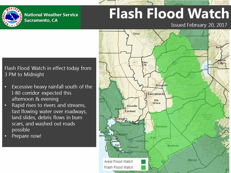
February 20, 2017 – The National Weather Service in Sacramento has issued a Flash Flood Watch for a portion of northern California, including the following areas: Motherlode, Northern San Joaquin Valley and West Slope Northern Sierra Nevada from 3 PM this afternoon to midnight tonight.
Latest short term model forecast guidance has suggested an area of excessive rainfall due to orographic lifting along and south of the Interstate 80 corridor with rainfall rates greater than 0.5 inches per hour possible. Locally heavier amounts are possible in a short time duration, which could lead to flash flooding.
Excessive heavy rainfall south of the Interstate 80 corridor is anticipated to develop this afternoon and evening.
Potential impacts include fast rises to rivers and streams, land slides, fast flowing water over roadways, and washed out roads.
A Flash Flood Watch means that heavy rain may develop that lead to flash flooding. Flash flooding is a VERY DANGEROUS SITUATION.
You should monitor later forecasts and be prepared to take action should Flash Flood Warnings be issued.