February 23, 2017 – Significant flooding concerns continue as runoff from the recent rain continues to work its way downstream adding stress to waterways. A couple of weak but cold storms move through Friday/Saturday then Sunday/Monday. An extended period of dry weather starts the middle of next week.
Discussion
Northern California is under upper level northwest flow between a low pressure system over the Great Basin and high pressure over the eastern Pacific. Weak disturbances dropping southeast in this northwest flow bringing a few showers to the Sierra and foothills this morning and this will continue to be a threat there today. The rest of the CWA will see mainly fair skies today under a cool airmass and cooler than normal daytime temperatures.
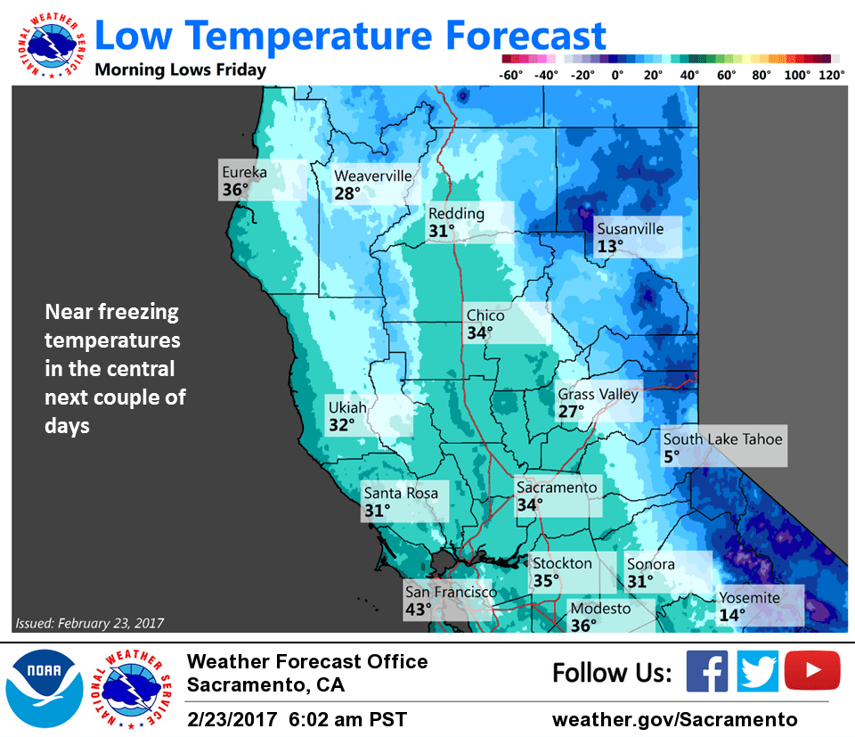
Friday looks likely mainly a dry day under weak high pressure. Fair skies in the morning under a cool airmass will make for a cold morning Friday. Morning lows will drop into the low to mid 30s in the Sacramento valley so areas of frost are likely.
Models in fairly good agreement in dropping a cold upper low down the Pacific Northwest coast during the day on Friday bringing a slight threat of showers to the northern mountains by the end of the day. This chance of showers spreads southward overnight Friday and Saturday as the upper low continues southward off the Norcal coast.
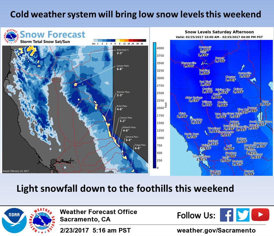
Snow levels with this system will be quite low and forecast between 1000 and 2000 feet. This is a fairly dry system and the main low center remains offshore so snowfall amounts at any elevation will be quite light and therefore have limited impact. Light snow will be possible well down into the foothills however with some areas receiving a dusting of snow where snow is relatively rare.
Early Sunday will see a brief break in precipitation before the next cold system drops down the Pacific Northwest coast and into Northern California. This system will track farther inland than the previous system and contain a bit more moisture. Therefore this system will be a bit wetter but still overall a fairly low precipitation maker. Some areas of the Sierra could see a few inches of snowfall. Snow levels with this system will be a little higher at between about 2000 and 3000 feet. Some minor travel impacts are likely due to the low snow levels and expect snowfall even over the lower elevation northern mountain passes.
Extended discussion (Monday through Thursday)
Large upper trof forecast to push into the Great Basin early next week leading to a decreasing threat of showers Monday with only a slight chance of mountain showers Tuesday. Upper ridge then builds into NorCal Wednesday into Thursday bringing dry weather with warming temperatures. High temperatures warm into the lower 60s midweek in the Central Valley.