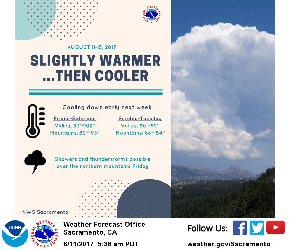
August 11, 2017 – A few showers and thunderstorms possible again this afternoon across the northern mountains, otherwise drier weather through the weekend. Not as warm by next week.
Discussion
Clear skies across interior NorCal early this morning except for some lingering cloudiness across the far northern portion of the state vicinity of the lingering low. Current temperatures are pretty similar compared to 24 hours ago.
Upper low continues to weaken today, though enough lingering moisture and instability left over with daytime heating to once again kick off a few showers and thunderstorms across the Coast Range and northern mountains. Temperatures are expected to be a bit warmer across the region.
Drier southwest flow takes hold over the weekend finally pushing the axis of deeper moisture and instability well to the east. Little change in temperatures Saturday, then gradual cooling early next week as deeper troughing develops along the West Coast.
Extended discussion (Tuesday through Friday)
Model guidance is in good agreement that an upper trough will drift eastward on Tuesday with daytime highs remaining near or slightly below normal. Ridge of high pressure from the EPAC will extend eastward by the middle of next week. Therefore, temperatures will warm back up to near or slightly above normal beginning on Wednesday. Expect valley highs to reach the mid to upper 90s, except for the northern Sacramento valley where temperatures could hit the century mark. The GFS indicates a weak upper trough moving across interior NorCal on Thursday which could lead to afternoon convection but the ECMWF does not show this feature at this point.