September 12, 2020 – Smoke and haze from wildfires will continue to impact air quality and temperatures. Weak weather system will bring onshore flow and periods of gusty winds Sunday through early next week as well as a chance of showers to the northern counties mid-week.
Discussion
To start off the weekend, Northern California will see another day of smoke and reduced air quality due to area wildfires across the state. Have continued to trend a few degrees lower than guidance as light winds today will likely not improve these conditions. Highs this afternoon across the Valley will generally range from the mid 80s to low 90s, with mountain temperatures peaking in the 70s. Similar temperatures are expected Sunday.

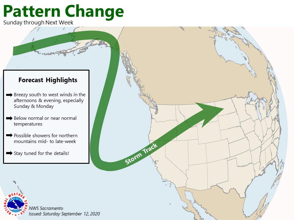
Upper ridging today will be replaced with a trough which begins to move over the west coast Sunday into next week. The main impact will be some breezy onshore winds and possibly cooler temperatures. Ensemble guidance has had a hard time with exact highs (with a range of roughly +/- 3 degrees) due to dense smoke, although would trend towards normal to below normal temperatures due to the troughing and any smoke in the area.
Onshore winds will begin to increase in the afternoon and evenings Sunday into early next week as the trough continues its slow progress towards the PacNW into NorCal. Valley winds may see gusts anywhere from 20-25 mph, locally stronger in the Delta and its vicinity. In the high Sierra, gusts up to 30-35 mph are possible with locally higher values in wind prone areas. These winds may bring some local fire weather concerns as fuels continue to be dry, although the onshore winds should help increase humidity a bit.
Models hint at the potential for light precipitation over the Coastal mountains as early as Tuesday, although the better chances look to hold off until later in the week.
Extended Discussion (Wednesday through Saturday)
Upper level trough will slowly approach the West Coast during the middle of next week. Forecast guidance has been generally consistent from run-to-run with respect to the anticipated onshore flow that will return to the region, though the trend has been toward stronger downstream ridging which would delay its onset.
This will result in south/southwest winds that will peak during the afternoon and evening hours, then subside after sunset. Fortunately, this onshore flow will also be accompanied with an uptick in relative humidity values. However, the timing of the afternoon breezes coinciding with the daily minimum relative humidity values may lead to brief periods of elevated and perhaps locally critical fire weather concerns.
Models have been hinting at some light precipitation chances WED- FRI as the upper low approaches and moves onshore, but the timing has been inconsistent from run-to-run. For now, leaving the NBM probability of precipitation in the grids. Probability of thunder remains under 10 percent at this time, but will continue to keep a close eye on the trends as models get a better handle on the timing and placement of this system.