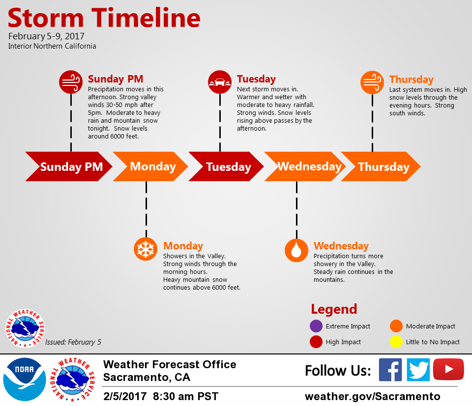
February 5, 2017 – Series of Pacific storms will bring periods of moderate to heavy rain and mountain snow with strong wind to Interior Northern California beginning tonight through Friday.
Discussion
Next storm is rapidly approaching the coast this afternoon with main moisture plume currently located between 130W and the CA coast. Forecast for the next 24 hours still largely intact with only minor changes. Latest hi-res guidance shows precipitation moving into the coastal range in a few hours, into the Valley by 4-6pm, and into the Sierra shortly thereafter.
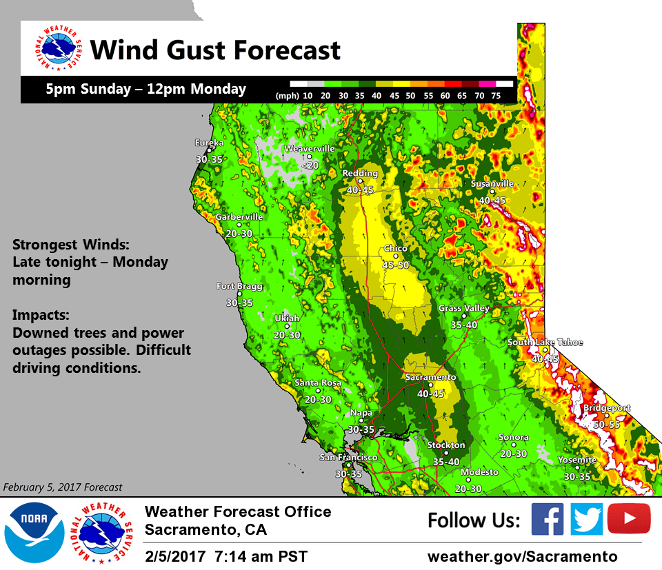
Winds will also begin to pick up in this timeframe, strongest late tonight into Monday morning. Wind advisory remains in effect with gusts of 40 to 50 mph across the central Valley and 50+ at highest elevations.
Possible downed trees or branches and localized power outages during this period. Moderate to heavy precipitation will continue overnight into Monday morning with substantial orographic flow across the Sierra.
Snow levels will remain around 5500-6000 feet with heavy snow and gusty winds causing treacherous travel and whiteout conditions at times across the passes. Winter storm warning remains in effect.
Main front moves through the Valley by Monday morning with precipitation becoming more showery during the day. Moderate to heavy precipitation will continue across the Sierra throughout the day. Winds will taper off after noon but will still remain breezy. Less instability noted in the models today than yesterday as there likely will be too much cloud cover around and not much of a break before the next storm moves in. Have kept thunderstorms out of the forecast again.
NorCal then will be hit by another moist Pacific storm, this one wetter and warmer than tonight’s. Another round of gusty winds is likely as the storm moves in. Heavy precipitation begins again Monday night into Tuesday. Latest guidance has bumped up precipitation amounts slightly for this period, especially across the mountains. Healthy rainfall totals and little break between storms will lead to rising water levels on area rivers and streams. Some road and localized urban flooding as well. Something to monitor for upcoming forecasts, have held off any sort of areal flood products for now to assess how much falls with the first storm. Tricky part of the forecast remains just how fast snow levels will rise.
Current projects have snow levels starting around 6000 feet Monday night with heavy snow impacting the passes through about Tuesday morning. Then steadily rising above pass levels (8000-9000 feet) Tuesday afternoon into evening. Exact timing will be key to impacts and travel hazards. Precipitation turns more showery again Wednesday.
Extended discussion (Thursday through Sunday)
Another storm system is on track to affect northern California this Thursday. Upper level trough deepens off the coast and strong low to mid level jet stream is anticipated to round the base and into the forecast area Thursday into Thursday night. The influx of stronger winds aloft and pressure gradient over the forecast area will create strong southerly winds, especially for higher terrain locations.
Plenty of moisture being advected ahead of the trough will allow for widespread moderate to heavy precipitation to develop. The system will be on the warm side with snow levels starting at 8000 feet and dropping to between 4000 and 5000 feet by Friday night. With previous snowfall and rain leading up to this incoming system, flooding is possible with the additional rainfall expected. Heavy rain should shift to heavy snow Friday as snow levels fall to below pass level.
The storm system will begin to exit northern California for the coming weekend when an upper level ridge of high pressure builds in from the west. Expecting conditions to dry out with temperatures warming to near normal.