March 24, 2017 – Rain and mountain snow today into Saturday with mountain travel impacts likely. Gusty winds today as well. Brief break in weather mid weekend.
Another system possible Sunday and Monday with another round of mountain travel impacts. Next storm clips NorCal and Sierra Wednesday and Thursday.
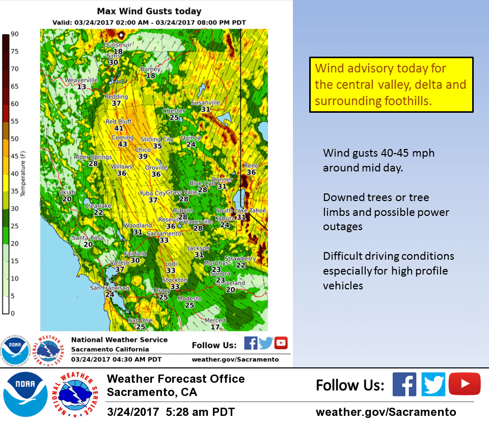
Wind Advisory from 9 am this morning to 7 pm this evening.
Discussion
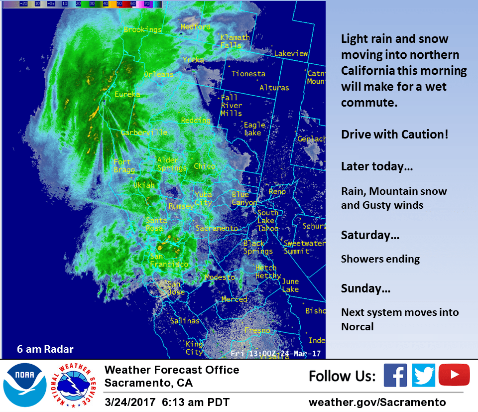
Pacific frontal band currently pushing into northwest California bringing precipitation as far southeast as a Red Bluff to Santa Rosa line. Southerly winds starting to pick up in the northern Sacramento valley with MFR to SAC surface gradient up to 10 mb. Some discrepancy between models as to max wind speeds this morning but depending on model, can find wind criteria throughout the Sacramento valley so have left current advisory through early this evening as is for now.
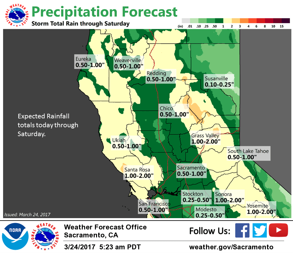
Significant snowfall over the mountains still on tap at pass levels so keeping winter storm warning as is for now as well. Main frontal clouds and precip looks to be over NorCal during maximum heating today and with lack of significant instability forecast by models, have removed threat of thunderstorms northern Sacramento valley for this afternoon.
Cloud cover this morning will preclude valley fog and combined with cooler airmass will bring cooler daytime highs today. Post frontal showers tonight will diminish on Saturday with upper ridging bringing brief drying period Saturday night. Cloud cover in advance of next upstream system should minimize valley fog threat.
Next upstream Pacific system quickly displaces upper ridge eastward into the Great Basin on Sunday with precipitation spreading across the north state as early as mid day with frontal passage through NorCal around Sunday evening. Snow levels with this system will create mountain travel impacts again Sunday into early Monday but this system should be a bit drier so snowfall totals should be a bit lower.
Upper ridging begins amplifying over the eastern Pacific on Monday pushing shower threat north and east to the northern mountains and Sierra Cascade range by Monday evening while the valley gets another break in the precipitation. Stabilization under the ridge along with northerly flow at all levels should preclude thunderstorm development Monday afternoon or evening.
Extended discussion (Tuesday through Friday)
Drier weather Tuesday as NorCal comes under the influence of upper ridging. Surface high pressure from the EPAC building through Oregon into the Great Basin will increase N-S surface pressure gradient over Interior NorCal leading to some breezy northerly wind Tuesday. Short wave trough moves through Wednesday into Thursday bringing a threat of showers mainly over northern and eastern portions of the forecast area.