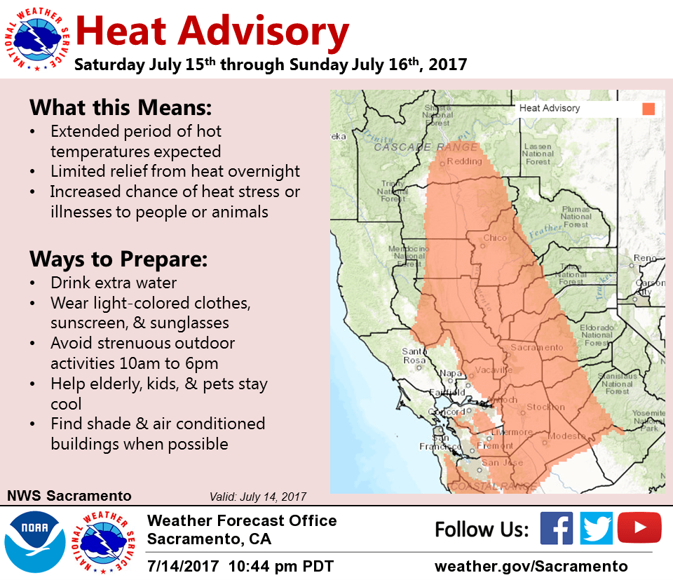
July 15, 2017 – Warm and dry this weekend with temperatures into the triple digits in the Valley. A few thunderstorms possible near the Sierra crest south of Lake Tahoe this weekend. Temperatures cooling slightly for next week. Heat advisory in effect.
Discussion
High pressure centered near the Four Corners region continues to keep the area under dry and warm conditions. Ridging will build slightly westward this weekend and combine with a suppressed marine layer to continue the warming trend for the weekend. Widespread triple digits likely across the Valley with hot temperatures as well at higher elevations. Warmest day should be Sunday when valley temperatures peak in the 102-107 degree range. In addition, overnight lows will remain on the warm side tonight. Heat advisory remains in effect from this afternoon through Sunday evening with an increased risk of heat-related illnesses, especially for sensitive groups. Monsoonal moisture will generally remain to the southeast of the area. Latest guidance still showing the possibility of a few thunderstorms popping up in diurnal heating, but expecting most activity to fire near or east of the Sierra crest. Have confined any chances for thunderstorms to the crest south of Lake Tahoe at this time.
Of other note, northerly flow will increase by Sunday with some locally breezy winds along the coastal range and western side of the Sacramento Valley. Afternoon humidity will likely lower into the single digits to low teens. This combined with the winds will lead to heightened fire weather concern. Any fire that starts may spread rapidly given very dry fuels below 5000 feet and breezy winds.
Temperatures will cool a bit by Monday into Tuesday as ridging shifts eastward and upper level troughing stalls out just offshore. Onshore flow will increase, with some breezy winds likely Monday evening into Tuesday. Though overnight humidity recovery may be a bit better than this weekend, very dry conditions will remain with continued fire weather concerns.
Extended discussion (Wednesday through Saturday)
Strong high pressure will continue hot and dry weather across the region during the second half of next week. While temperatures will be above average, enough onshore flow is expected to keep extreme heat at bay. Monsoon moisture is expected to remain to the south and east of NorCal.