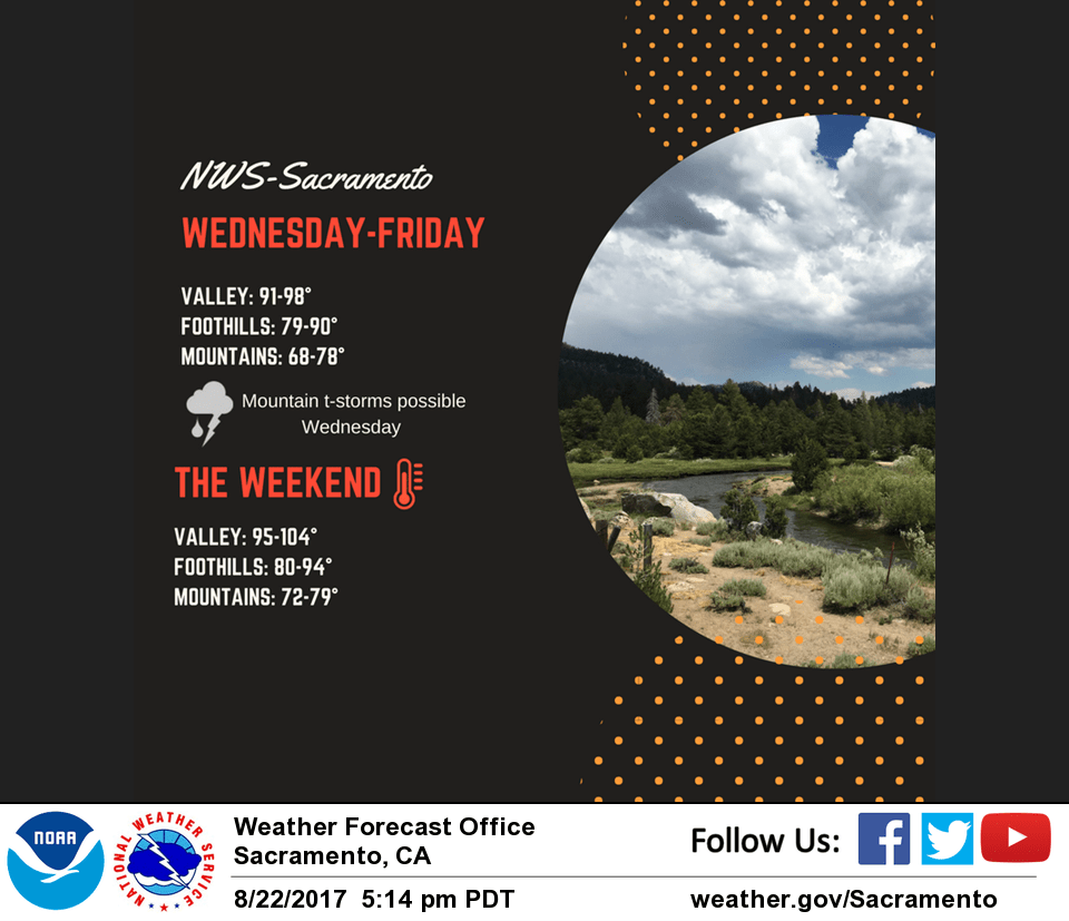
August 23, 2017 – Hot and dry weather returns to the region later this week with temperatures returning to well above average by the weekend.
Discussion
Some debris cloudiness left over from last evening’s thunderstorm activity lingers across far northern California and portions of the northern Sierra Nevada. Otherwise, skies are clear across the region early this morning. Current temperatures are milder across most of the area compared to 24 hours ago and range from the upper 40s in the mountain valleys to the mid 70s across the warmer portions of the Sacramento Valley.
Low pressure that’s been parked along the central California for the past several days is forecast to shift east into SoCal by Thursday as a northern stream system approaches the PacNW. Enough moisture and instability lingers for one more day of shower and thunderstorm chances across the northern Sierra before the deeper moisture and instability is shunted eastward.
Temperatures remain close to average the next few days, then hotter weather returns for the weekend as high pressure strengthens along the West Coast.
Extended discussion (Sunday through Wednesday)
Quiet weather pattern ahead for the long term forecast period. A stable upper level ridge of high pressure positioned over the west will provide clear skies and dry weather with above normal temperatures across northern California. Temperatures are expected to gradually cool closer to normal towards the middle of next week.