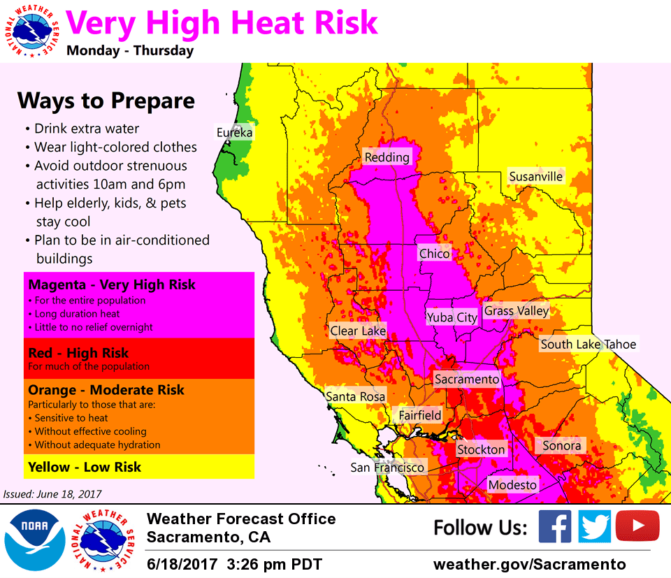
June 19, 2017 – An extended heat wave continues through most of this week with widespread highs over 100 degrees and warm nights. Isolated late- day thunderstorms possible over the mountains into mid-week.
Discussion
Isolated elevated convection continues across NorCal early this morning ahead of a short-wave lifting up from the south around the weak low circulation off the central California coast. Radar still indicates a few sprinkles between Sacramento and Stockton, but the earlier thunderstorm activity that affected the Bay Area has weakened and moved north.
Hot weather continues to be the main weather story this week with record heat expected to continue. Current temperatures remain very warm ranging from the 50s and 60s in the mountain valleys to the 70s and lower 80s elsewhere. Light easterly downslope winds are maintaining temperatures in the mid to upper 80s in the Chico and Oroville areas.
A Delta trickle has developed and will bring a little cooling to that region today thru Tuesday, and may even shave a few degrees off what we would otherwise experience in the Sacramento region. Otherwise, the hot weather continues across the region this week with more records in jeopardy.
Some record highs are listed below.
Record Highs………..Today……Tuesday….Wednesday
Redding Apt…………104(1988)..107(2001)..110(1992)
Red Bluff…………..110(1970)..110(1970)..110(1962)
Sacramento………….106(1988)..108(1920)..108(1961)
Sacramento Exec……..105(1988)..109(1961)..111(1961)
Stockton……………108(1981)..107(1981)..111(1961)
Modesto…………….105(1981)..106(2008)..109(1973)
Weak wave and lingering mid/upper level moisture combined with daytime heating over the higher terrain will lead to more isolated late-day thunderstorms over the NorCal mountains into mid-week.
Delta breeze expected to shut down again Wednesday and Thursday as high pressure strengthens a bit resulting in the warmest temperatures of the week for the Delta and Sacramento region.
Extended discussion (Friday through Monday)
The strong ridge will remain in place for the extended period keeping the hot dry weather around. The Excessive Heat Warning will remain in effect on Thursday as highs once again will be 105-110 for the valley and into the 70’s to lower 90’s for the higher elevations.
A trough to our east will be digging south and that will help to bring slightly lower heights for us and a small cool down. Highs will be just above the 100 mark for Friday but possibly falling below the 100 mark by Sunday.
Closer to average overnight lows will also return by Friday night. A delta breeze dose look to develop on Friday and continue into the weekend and that should bring some relief from the heat for the Delta regions. We do start to see some weak instability build into the higher elevations over the weekend but not expecting any showers or t-storms at this time.