May 31, 2021 – Well above average temperatures with dry conditions continue. Record daily highs possible on Memorial Day. Temperatures lowering slightly by the weekend.

Discussion
Generally clear skies and relatively warm temperatures are being observed early this morning across interior Northern California. Temperatures are running anywhere from 5 to 15 degrees warmer than this time yesterday.
As of 2:22 AM many locations in the Northern Sacramento Valley and adjacent foothills are reporting temperatures in the upper 70s to mid 80s. The Southern Sacramento Valley and San Joaquin Valley are generally in the 60s and 70s.
Not much in the way of a marine layer can be seen on satellite this morning. The Fort Ord profiler also indicates a depth of less than 1,000 feet. Therefore, less cooling is expected overnight tonight in the Delta influenced areas as compared to yesterday.
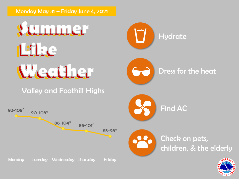
Ensemble guidance is in very good agreement high pressure over the region will lead to a dangerously hot Memorial Day with record highs possible across interior Northern California. Temperatures are forecast to warm-up quickly with widespread 90s expected by late morning across the Valley.

Highs will range from 20 to 25 degrees above climatology for this time of year. Maximum temperatures are expected to soar to around 106 in the Sacramento Metro area and upwards of 108 to 109 in the Northern Sacramento Valley.

Overnight lows will also be above average with areas along thermal belts possibly only cooling into the mid 70s overnight. Very dry conditions are also expected with widespread minimum daytime relative humidities in the single digits to teens for much or interior Northern California.
Increased Delta cooling is expected overnight Monday into Tuesday due to a deepening marine layer as indicated by HREF. This will likely only lead to temperatures lowering by a few degrees in the Sacramento region and San Joaquin Valley. However, areas closest to the Delta may see temperatures lower slightly more. We could see breezy conditions though the Delta continue into mid- week.
Ensemble guidance also indicates a possible low pressure system edging into the Pacific Northwest by mid to late week weakening the upper-level ridge. This will likely lead to temperatures lowering slightly as well as increased onshore flow.
Extended discussion (Friday through Monday)
Cluster analysis indicates the late-week trough will mainly affect areas to the north, but should still help to bring modest cooling and at least moderate Delta breezes.
As the trough shifts east, some minor warming in the valley along with northerly breezes is possible for next weekend. Dry conditions will persist.