July 6, 2017 – Hot and dry through the weekend. Isolated thunderstorms possible near the crest and mainly south of Lake Tahoe each day.
Discussion
Satellite imagery shows some high clouds moving northward around the periphery of the Southwest high into NorCal. Onshore flow is weakening and the marine layer has become more shallow (less than 500 ft on the Fort Ord profiler). Current temperatures are running a little milder compared to 24 hours ago and generally range from the mid 40s to lower 50s in the mountain valleys to the 60s to mid 70s elsewhere.
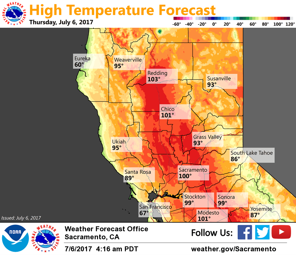
High pressure will strengthen across the region the next few days as the Southwest high extends westward. The result will be warmer temperatures across interior NorCal with little marine influence making it inland as the marine layer remains shallow. Highs will likely peak Friday and Saturday with most of the Central Valley expected to be above the century mark.
Onshore flow may return early enough on Saturday to provide some cooling for the Delta and Sacramento region with cooling expected to extend further inland on Sunday as a short-wave trough approaches the West Coast nudging the ridge a bit to the east.
Late-day thunderstorm chances likely to remain confined to the Sierra Nevada to the south of Lake Tahoe over the next several days.
Extended discussion (Monday through Thursday)
Southwest flow aloft between the Four Corners High and a trough over Eastern Pacific with above average temperatures through the extended. Thunderstorms are possible near the crest southward of Highway 50.