Warming trend through the weekend, then turning hot by mid-week. A weak system may bring a few showers to the Coast Range and Northern Sacramento Valley over the weekend.
Discussion
Strong upper low will remain just off the British Columbia coast through the weekend and keep an unseasonably strong trough southward over the eastern Pacific and along the West Coast. Breezy onshore winds will continue through the Delta at times into the weekend. Temperatures will be slightly below normal in the low 80’s today, then warm to slightly above normal readings near 90 degrees Saturday through Monday.
A few light showers will be possible at times over the Coast Range and Northern Sacramento Valley through Monday morning total rainfall amounts over the period should be less than 0.10 inches. Little to no instability is forecast, so not expecting any thunderstorms at this time.
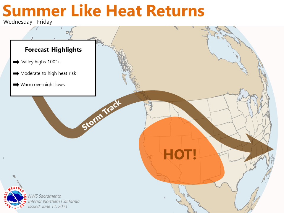
Extended discussion (Tuesday through Friday)
Ensembles and cluster analysis continue to indicate a return to very hot conditions by mid-week. Although, the timing of the extreme warm-up is still a little uncertain. A few of the clusters keep more troughing over the Pacific Northwest, which would keep temperatures several degrees cooler than latest NBM.
At this time cannot say confidence is more than medium for a high heat event (Wed-Fri) given ensemble/cluster spread and the uncertainties on how large trough over the eastern Pacific will transition into southern Canada next week. Stay tuned to the next few model runs to see if confidence in triple digit heat mid to late week increases.