Hot and dry weather continues today with locally breezy northerly winds. Much cooler weather returns Thursday, and shower chances return to the mountains and northern Sacramento Valley over the weekend.
Discussion
Strong upper ridge is currently moving overhead and skies are clear across the region. The north-south surface pressure gradient (MFR-SAC) has weakened a bit since Tuesday, but is still sufficiently strong for northerly gusts of 15-30 mph along the western edge of the Sacramento Valley. The northeast gradient (RNO-SAC) has tightened and is approaching 7 mbs resulting in local gusts of 25-35 mph in the northern Sierra.
Current temperatures are very mild and are around 5 degrees warmer compared to 24 hours ago across most of the area. Readings range from the mid 60s to upper 70s across the Central Valley.

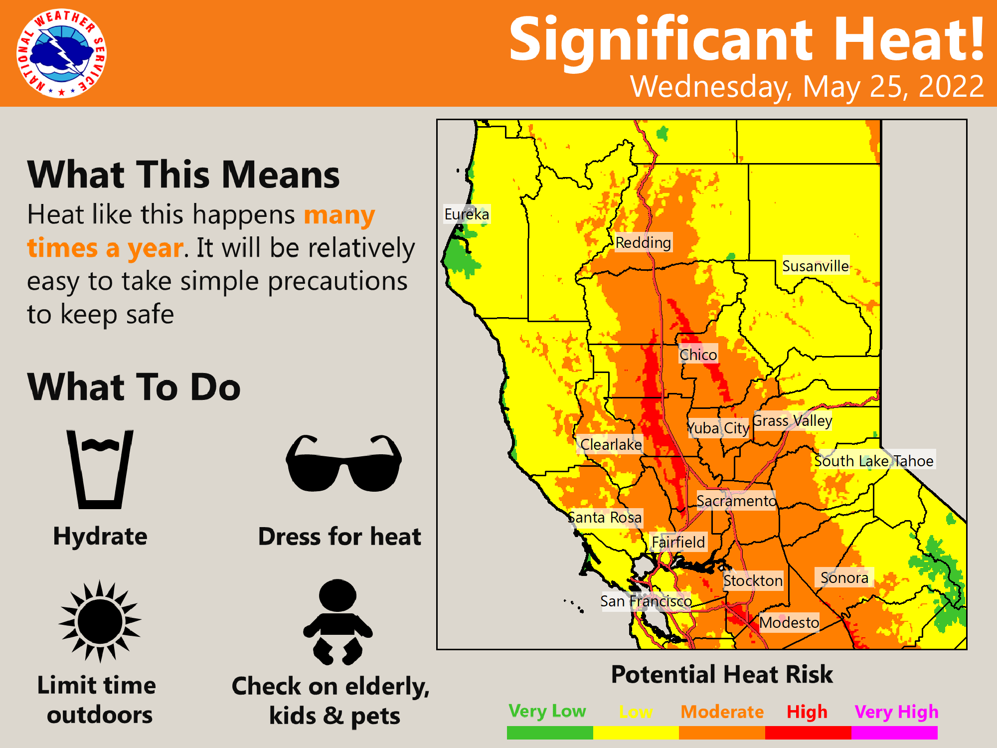
Hot and dry conditions persist today as the mid/upper ridge shifts east. Highs today will up a few degrees compared to Tuesday, and a few daily records will be possible as readings climb into the 100-105 degree range across the Central Valley.
Offshore gradients will gradually slacken, and flow will transition to onshore this evening as the upstream trough approaches. A robust Delta Breeze is forecast to develop tonight and continue Thursday, and combined with synoptic cooling will result in much cooler temperatures across the region beginning on Thursday.
A few showers will be possible across the northern Sacramento Valley and northern mountains on Saturday as a stronger short-wave moves through the region.


Extended Discussion (Sunday through Wednesday)
Cooler temperatures continue into the holiday weekend as a trough deepens over the western US. As the trough passes over NorCal Sunday and Monday it could bring a few light showers, especially over the mountains. Clusters show high pressure building inland early next week resulting in dry and warmer weather with some gusty north to east wind, possibly bringing back elevated fire weather concerns.