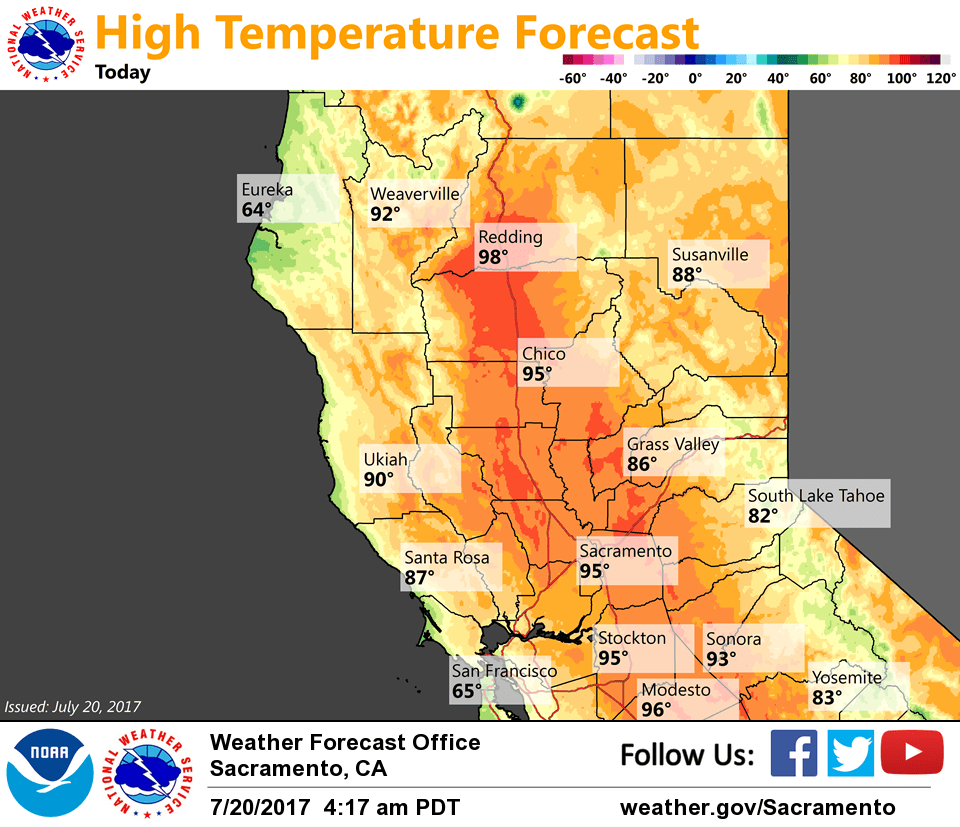
July 20, 2017 – Hot and dry weather continues with locally breezy conditions. Hotter weather for the weekend. Excessive Heat Watch from late Friday night through Sunday evening for Northeast Foothills/Sacramento Valley-Northern Sacramento Valley.
Discussion
Areas of smoke originating from the Detwiler Fire continue to spread over portions of the Motherlode and Northern Sierra Nevada, otherwise skies remain clear across interior NorCal. Current temperatures are pretty similar across most of the region compared to 24 hours ago with 40s and 50s in the mountain valleys and upper 50s to around 70 elsewhere.
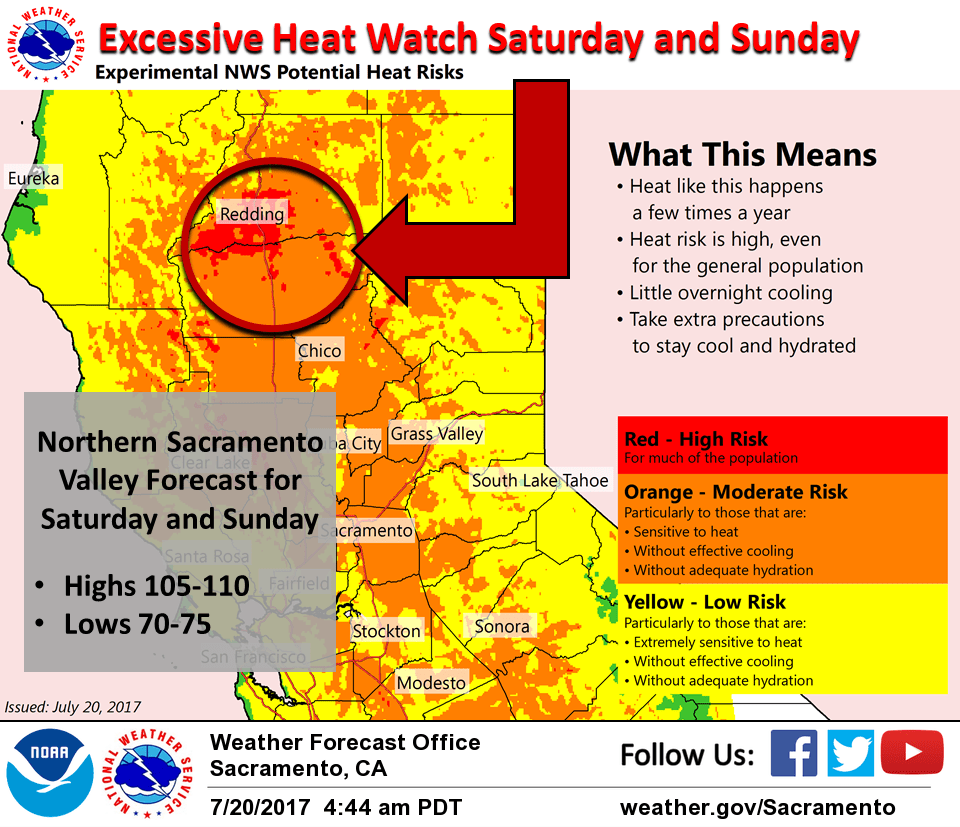
Little change expected today as dry southwest flow continues across NorCal. Hotter weather returns beginning Friday and accelerates over the weekend as the Southwest high extends westward bringing synoptic warming and suppressing the marine layer. Highs Saturday and Sunday will likely make it into the 105-110 range across the northern Sacramento Valley with overnight lows only dropping into the lower 70s – so a heat watch has been posted for that area.
While it will be hot, enough of a Delta trickle is expected into the Central Valley to keep temperatures in the Sacramento and Stockton areas somewhat in check over the weekend.
Enough moisture may move northward late in the weekend for some isolated late-day thunderstorms over the northern Sierra Nevada.
Extended discussion (Monday through Thursday)
An upper low off the NW California coast Sunday weakens and gradually drifts inland across northern portions of the state early next week. There will be a slow cooling trend into midweek. This system may pull up enough monsoonal moisture to bring a slight chance of afternoon thunderstorms over the Sierra crest south of Highway 50 Monday into Wednesday. Most of the more favorable conditions will remain to the south and east, though.