Hot weather is forecast for much of this week with widespread triple digit high temperatures in the Valley. Smoke from area wildfires will continue to impact portions of interior Northern California. Monsoonal showers and isolated thunderstorms will be possible each day with best chances over the Sierra north into the Shasta County mountains Wednesday – Thursday.
Discussion
Temperatures across interior Northern California early this morning are reading around 2-8 degrees warmer than yesterday for most locations. Temperatures will warm another couple of degrees today as upper level high pressure builds over the region.
Ensemble guidance is in good agreement that high pressure will continue to build over the Western US this week, with temperatures warming to 7-15 degrees above daily normals.
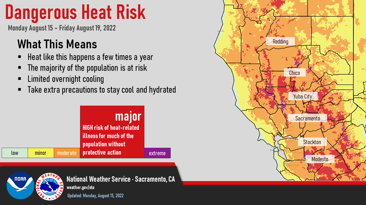
Clusters indicate the strong ridge will peak Tuesday into Wednesday, along with the temperatures peaking around 103-108 degrees in the Valley, 95-105 degrees in the foothills and Delta region, and 70s to low 90s in the mountains.
Overnight temperatures will remain relatively warm as well, especially in the foothills. Valley low temperatures may only fall into the upper 60s to low 70s with the thermal belt regions in the foothills remaining in the mid 70s.

The hottest temperatures will be observed in the northern Sacramento Valley and adjacent foothills. These temperatures will create moderate to high heat risk across Northern California, and an Excessive Heat Watch remains in effect from Tuesday morning through Friday.

Confidence is increasing in monsoonal moisture making a push back into Northern California this week. Isolated showers and thunderstorms will be possible along the Sierra crest north into the Shasta County mountains Tuesday through Thursday. PWATs will be around 0.5 inch on Tuesday, increasing to 0.75 inch Wednesday – Thursday, and CAPE values are around 100-500 J/kg, all of which are enough to produce isolated thunderstorms along with orographic lift.

The main threat with any thunderstorm would be locally heavy rainfall, gusty winds, and lightning as well as the possibility for fire starts if lightning strikes outside of rainfall. If you have outdoor plans this weekend, be weather aware with the heat and thunderstorms!
Extended Discussion (Friday through Monday)
Upper ridging over NorCal slowly progresses through the extended period as upper low off the West Coast approaches. Cooling through the period however high temperatures remain above average. Models trending drier with deep moist convection over our portions of interior NorCal.