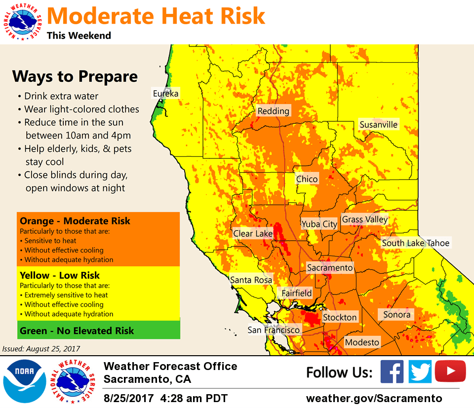
August 25, 2017 – Warm up still expected, approaching heat advisory levels on Sunday and Monday.
Discussion
High 500 mb heights over the day today as a weak trough spins off the coast. Trough and energy moving across southern Canada will keep the upper ridge under control a bit today, but still a very warm day.
Saturday through Monday, southern Canada energy pushes into Great Lakes allowing upper ridge to really bump up with increasing heights and low level temperatures. NAEFS low level temperature anomalies values in the 3’s. Result is widespread 100s with lows in the upper 60s with a few lower 70s. These values are kicking in heat risk values that support possibly heat advisory for this time of the year. Will hold off with an advisory right now and continue to cover with weather story and social media. Day shift might need to pull trigger especially if trend continues of slightly warmer forecast.
Extended discussion (Tuesday through Friday)
Ridge of high pressure aloft will continue to bring above average temperatures across interior NorCal with highs remaining about 5-12 degrees above normal. The upper ridge will slowly erode on its western periphery and shift eastward by mid-week. However, temperatures will still remain above normal. Latest model guidance vary in location and strength of an upper trough off the coast of CA, which would pull some monsoonal moisture northward into our area beginning on Tuesday. Models are also indicating elevated instability leading to late-day convection near the Sierra crest mainly south of Highway 50. Therefore, have introduced a slight chance for isolated thunderstorms.