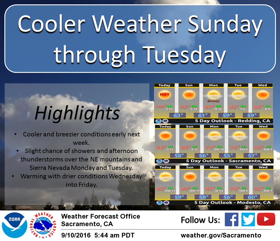
September 10, 2016 – Above normal temperatures continue today, then cooling trend Sunday through Tuesday with a slight chance of mountain showers or thunderstorms. Dry Wednesday through Saturday with warming back above normal.
Discussion
High pressure will continue today with temperatures remaining above normal. They should generally be near yesterdays highs for most areas with only slight cooling expected today. The marine layer is around 1500 feet deep with low clouds into the western delta this morning. Temperatures have been trending cooler for the Bay Area and Northern Sacramento Valley with the remaining areas near yesterdays values.
Sunday through Tuesday is when we expect a decent cooling trend. Temperatures will be dropping each day by 5 degrees or more. Monday and Tuesday’s temperatures will feel a bit more fall like than summer. The trough is mostly dry but will bring some chances of showers and thunderstorms along the crest Monday and Tuesday along with some breezy conditions late Sunday and Monday.
Extended discussion (Wednesday through Saturday)
Ridging from the eastern Pacific builds into NorCal later next week as the early week system shifts east. Temperatures will return to above average.