November 23, 2016 – A storm system exits the region today. Another cold system is expected to affect the region late this week.
Discussion
Radar and satellite imagery show the frontal band precip moving out of the valley and concentrated mainly over the northern Sierra Nevada early this morning. Moderate to occasionally brief heavy snow has been occurring over the Sierra above about 4K feet. Blue Canyon has picked up around 3 inches of snow accumulation so far.
Deep convection beneath the upper trough, presently along the northwest coast of California, will continue shower chances across the far northern portion of the state. Otherwise, precip will taper off pretty quickly in most areas this morning.
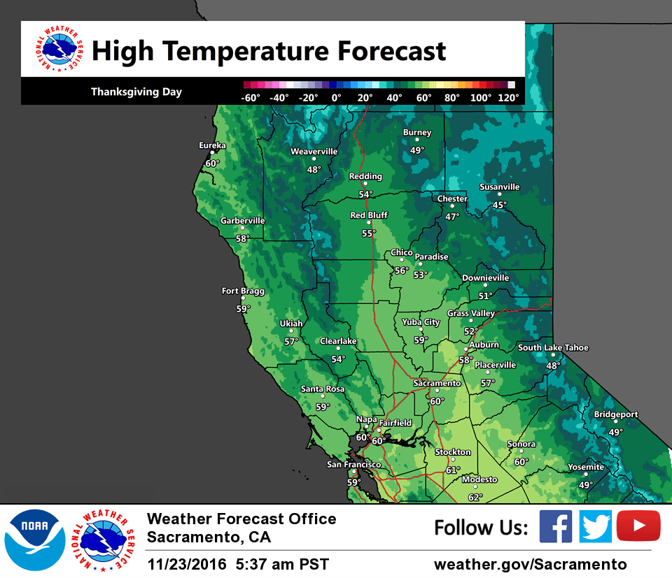
Short-wave ridging moves overhead NorCal tonight into Thanksgiving returning dry weather to most of the region along with clearing skies, though enough warm-advection and moisture may linger across the far northern portion of the state for some light precip. Patches of valley fog will be possible once again Thanksgiving morning.
Still quite a bit of uncertainty in timing the return of precip across NorCal this weekend. Models continue to struggle with how much the system will dig off the coast on Friday slowing the eastward progression of the system and onset of precip for NorCal. It appears we’ll still stand a good chance of precip, but a majority may occur on Saturday rather than Friday. It bears watching as it has the potential for more significant snowfall accumulations across the mountains during the holiday weekend.
Extended discussion (Sunday through Wednesday)
The main trough will begin to exit northern California Sunday morning as another shortwave trough dives into the forecast area Sunday afternoon. Rain showers and snow to elevations above 3500 feet will persist through Sunday evening. A shortwave ridge of high pressure will provide clearing skies and dry weather Monday and Tuesday with near normal high temperatures. Model forecasts have some timing and amplitude differences for the middle of next week, but another weather making system looks possible at this time to bring rain and snow to the forecast area.