June 26, 2017 – Cooler, but still remaining close to average into the weekend.
Discussion
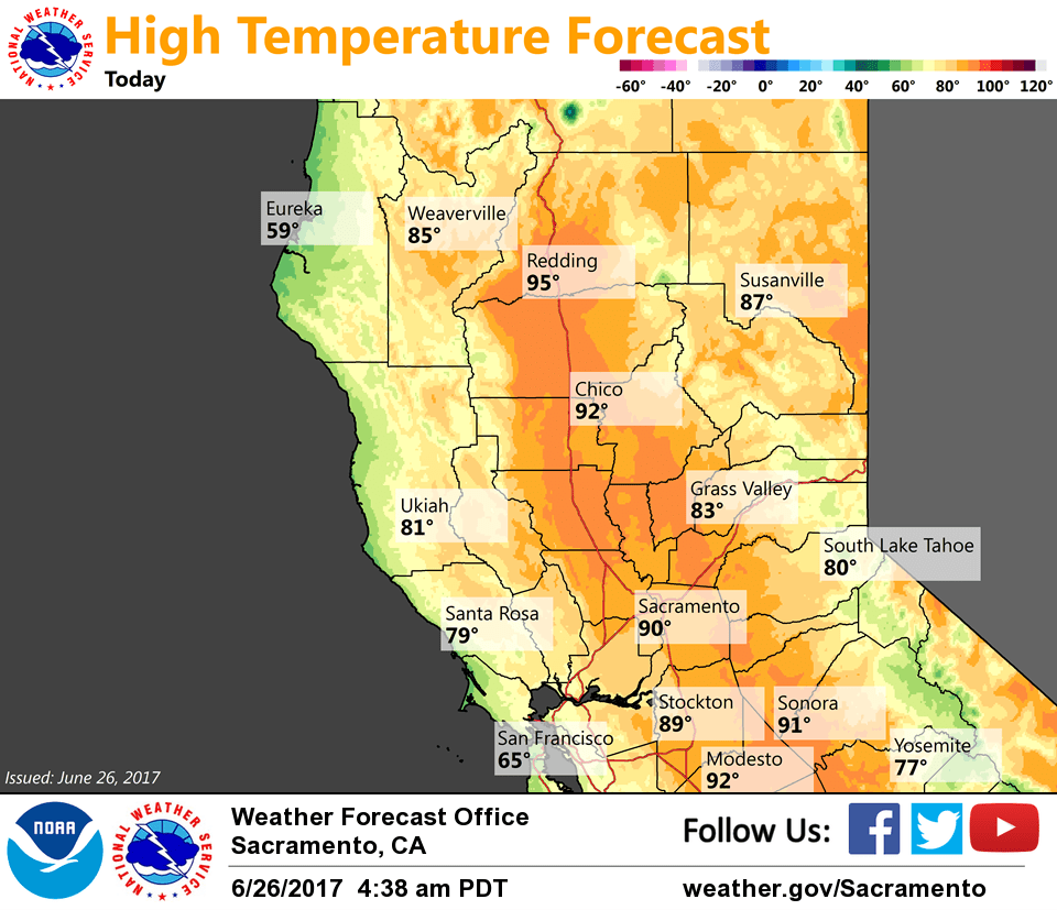
Week upper troughing along with continuing onshore flow will spread cooling further inland today with daytime highs forecast to come in close to average for late-June. Fair skies and a bit more cooling expected on Tuesday as weak upper troughing lingers along the west coast. Upper ridge begins to rebuild by mid-week bringing the beginning of a warming trend. Thunderstorm chances likely to remain to the north and east of the forecast area.
Extended discussion (Friday through Monday)
Warm weather should continue into Friday as high pressure over the eastern Pacific nudges into Northern California.
A series of weak upper troughs then begins to move through the region next weekend, bringing another cooling trend along with increased onshore flow. The GFS is a bit stronger with the series of troughs than the ECMWF, but neither solution would be particularly impactful for our area.