April 26, 2017 – Weak weather system will bring light precipitation today. Dry with gusty north winds developing late in the week.
Discussion
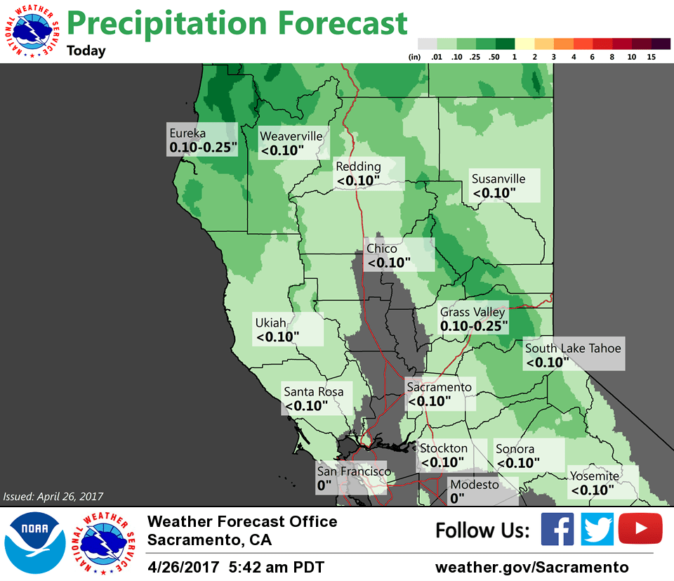
Clouds and even a few light showers have been increasing across interior NorCal overnight as the latest weather system moves into the region. Current temperatures are considerably milder compared to 24 hours ago and generally range from the mid 30s to mid 40s in the mountains with mainly 50s elsewhere.
Only light amounts of precipitation are expected across the region into this evening as the system slides down in west-northwest flow over the eastern Pacific ridge. Rain totals in the valley will likely only amount to a few hundredths of an inch while some northern Sierra locales may see between a quarter and half an inch. Snow levels will be above 8K feet through the event, so little or no impact to travel expected through the higher northern Sierra passes.
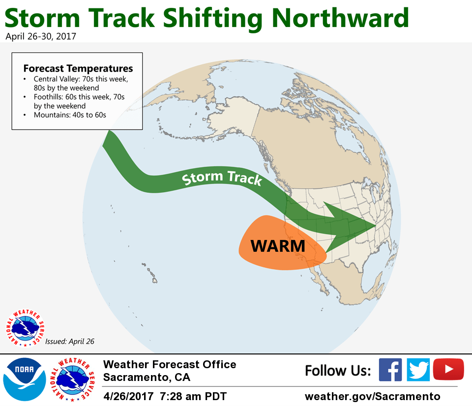
Amplifying upper air pattern forecast across western North America beginning Thursday as the trough deepens to our east around the Four Corners region by Saturday while upstream ridging over the eastern Pacific edges onto the West Coast. This will bring a return of dry and milder weather to interior NorCal along with periods of breezy north winds to the Central Valley.
Extended discussion (Sunday through Wednesday)
High amplitude upper ridging in the EPAC extends over Interior NorCal through the weekend resulting in dry conditions with above normal temperatures. Ridging may weaken some over northern portions of CA Monday as a short wave trough digs through the PACNW into the Great Basin. This could bring minor cooling over northern portions of the forecast area Monday. High pressure rebuilds behind the wave Monday night into Tuesday resulting in a return of gusty northerly wind. Breezy conditions continue into Wednesday as ridge axis shifts inland and temperatures increase to upwards of 15+ degrees above normal.