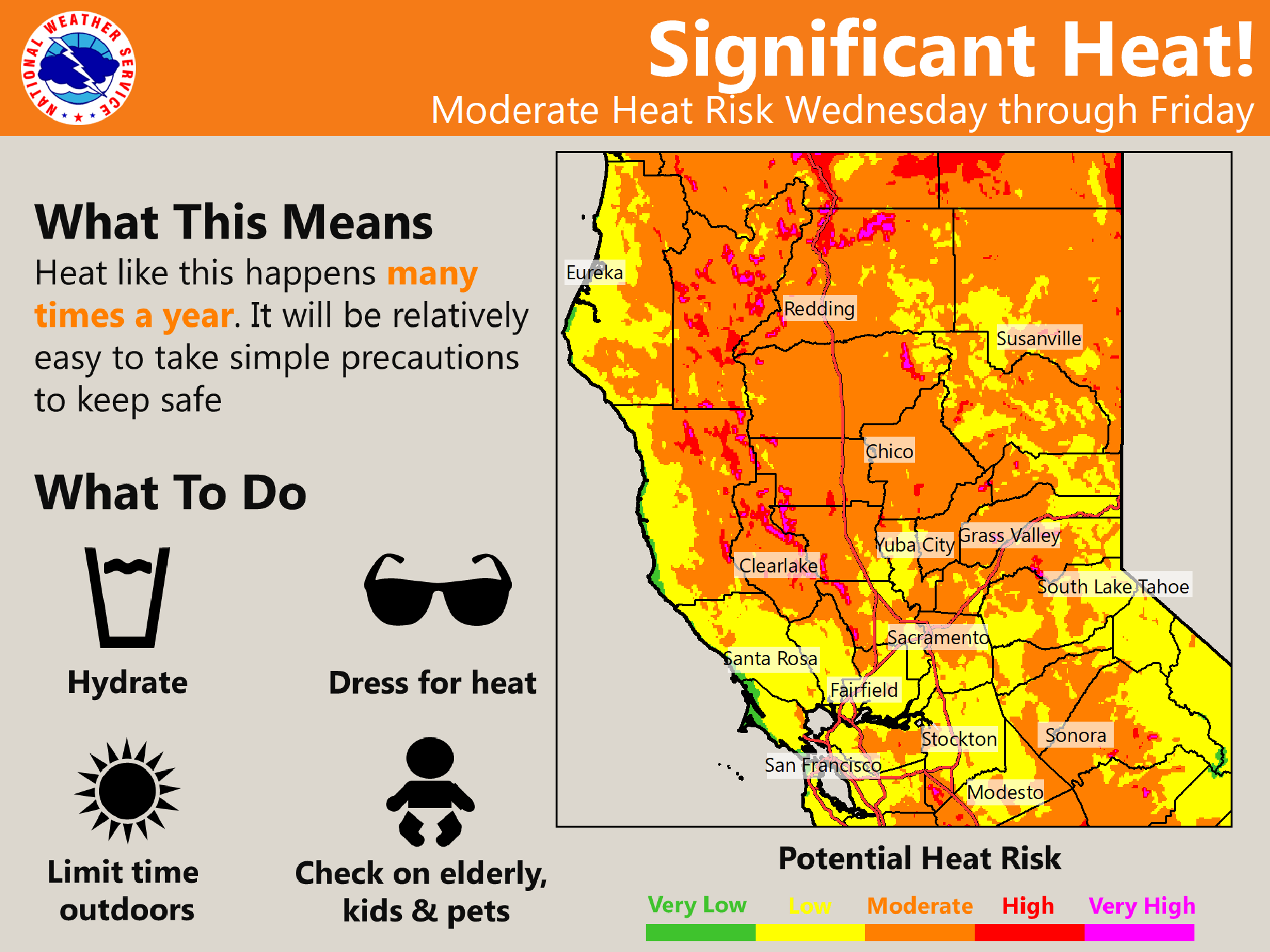
Less smoke today with continued dry weather. Increasing onshore winds will bring some better clearing of the smoke today. A gradual warming trend will lead to moderate heat risk later in the week.
Discussion
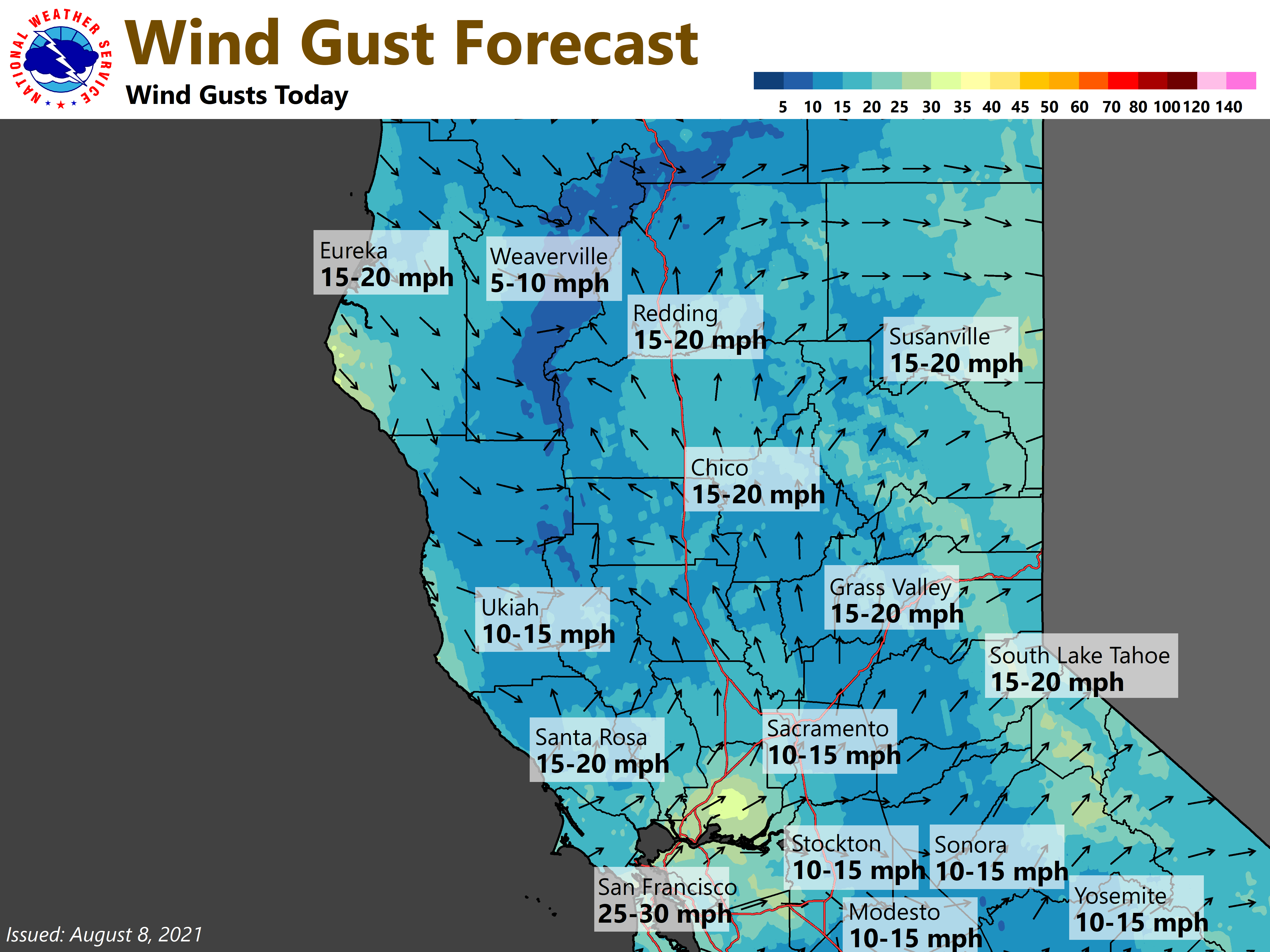
Smoke will continue to impact parts of the region today but there will be continued improvement throughout the day. A low pressure area will move through the Pacific Northwest has shifted the winds and is bringing us a stronger Delta Breeze.
This will also help to cool temperatures synoptically but there should be less of a smoke layer to hold down temperatures as much as Saturday. Have indicated slight warming over yesterdays highs for most areas which puts temperatures around seasonal normals.
Significant improvement later this afternoon and evening over the region with the smoke but some north to easterly drainage winds setting up tonight may bring some smoke back into the northern half of the Sacramento valley by Monday morning.
A ridge of high pressure will then build heating temperatures up each day with temperatures mainly becoming 100 plus throughout the central valley by Tuesday and approaching 110 degrees over the north end of the valley on Tuesday as well.
Continued hot inland on Wednesday but some moisture moving up from the south may start to bring some shower and thunderstorm chances back to the Sierra Nevada crest.
Extended Discussion (Thursday through Sunday)
Strong high pressure will remain in place with places well inland away from the Delta warming into the 105 to 110 range in the central valley. Temperatures will be hot in Sacramento as well but daily changes to the Delta Breeze should mainly keep us in the upper 90s to 105 degrees range during this period.
Monsoonal moisture will continue each day through Saturday to bring chances of showers and thunderstorms along the crest. By Sunday a trough will deepen over the west to help push the monsoonal moisture to the east and cool inland temperatures.