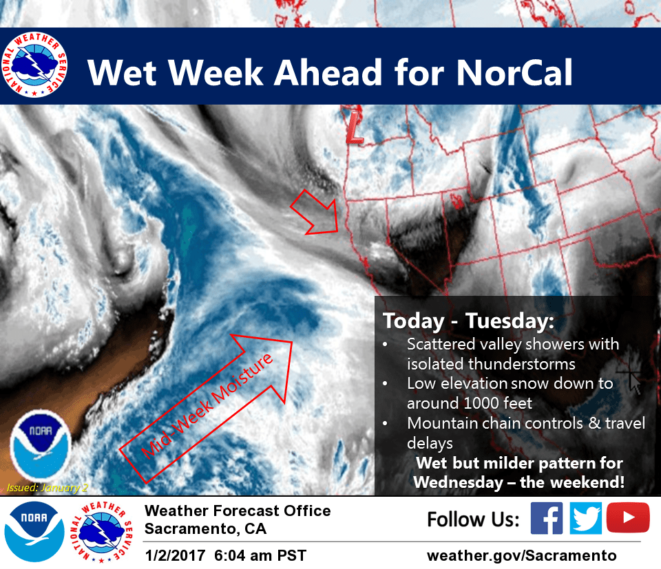
January 2, 2017 – Colder system moves in today into Tuesday with snow levels dropping down into the foothills and northern Sac Valley. Wet but milder pattern for mid-week into next weekend.
Winter Weather Advisory until 10 AM PST Tuesday for Burney Basin / Eastern Shasta County-Motherlode-Northeast Foothills/Sacramento Valley-West Slope Northern Sierra Nevada- Western Plumas County/Lassen Park.
Winter Storm Warning from 10 AM Tuesday to 4 AM PST Thursday for Shasta Lake Area / Northern Shasta County-West Slope Northern Sierra Nevada-Western Plumas County/Lassen Park.
Discussion
Mostly light showery precip across NorCal today with the upper low across the PacNW and rather limited available moisture. Upslope flow will continue light to moderate snow showers across the west slopes of the northern Sierra Nevada where impacts to travel are expected to be the most pronounced today. Showers may pick up somewhat by this afternoon as a channel vort rotates across the far northern portion of the state, and even a few thunderstorms cannot be ruled out from the Sacramento area northward.
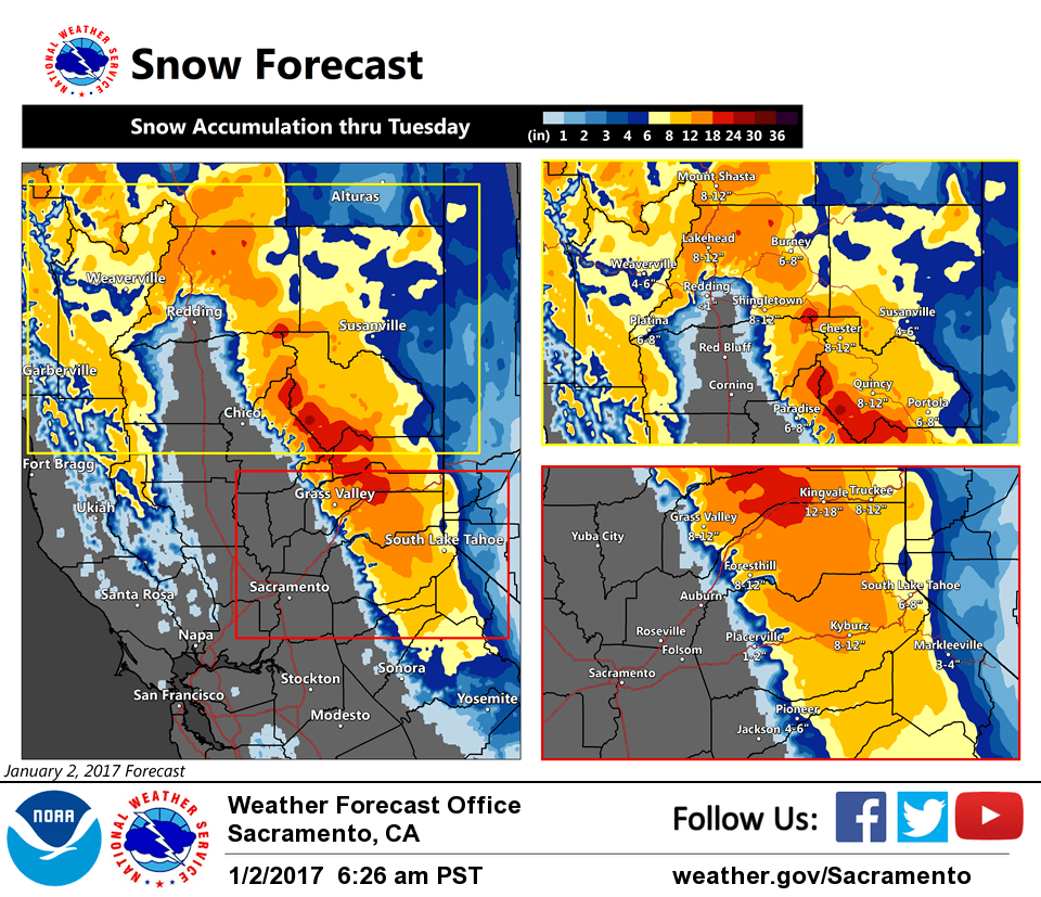
Moisture and precip forecast to increase across the region by Tuesday as the PacNW low retrogrades a bit. Snow levels will begin to increase, though colder air will likely remain entrenched across Shasta County until Tuesday night. Heavy snow will be likely across the Shasta County mountains and over the northern Sierra where up to 2 feet of accumulation will be possible.
At this time, it’s looking like snow levels across the northern Sacramento Valley may be down to the valley floor initially, but most accumulations will be above around 1000 feet. However, we’ll be keeping a keen eye on the KRDD dew point and wind direction for the potential for more significant snow in the Redding area as Currently the dew point is 34 and winds are from the south.
Present indications are that there will be somewhat of a break in the weather across NorCal Thursday into Friday before another more significant system moves in for the weekend.
Extended discussion (Friday through Monday)
A brief lull in precipitation is expected Friday, as shortwave upper level ridging moves through in the wake of departing low. Some lingering showers are possible, mainly over higher terrain, with generally dry weather expected in the Valley.
Models are coming into much better agreement with wet weather returning Friday night. A strong system from the Gulf of Alaska will bring an extended period of wet weather with a strong Pacific moisture plume through the weekend and potentially beyond. Snow levels are expected to be higher than the current system, but should be below pass levels through the weekend into early next week. If this pattern holds together, it could bring significant amounts of rainfall and mountain snow, continuing well into next week.