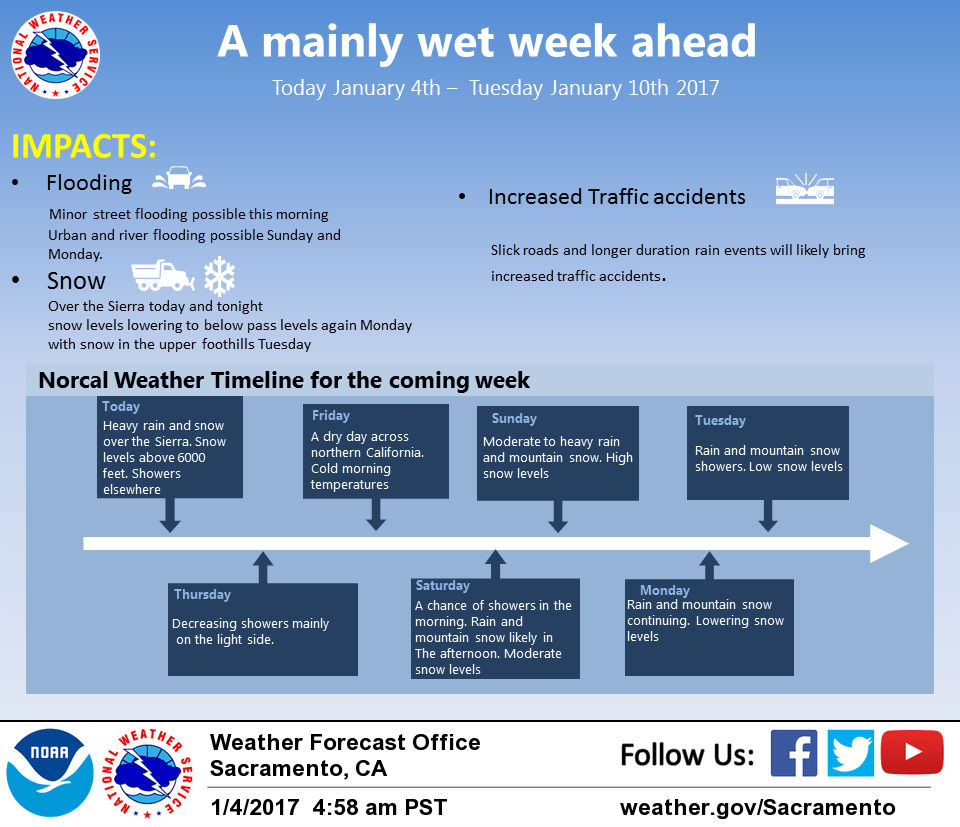
January 4, 2017 – Rainy and windy this morning with continued heavy snow over the Sierra through tonight. Precipitation ending Thursday then returning again late Friday. Moderate snow levels Saturday then climbing early next week. Wet pattern continuing with lowering snow levels through mid week.
Flood Watch through Thursday morning for Motherlode-Northeast Foothills/Sacramento Valley-West Slope Northern Sierra Nevada.
Discussion
A Pacific frontal system has pushed into northwest California this morning bringing continued precipitation to most of the forecast area. A transition to showers will occur over much of the CWA today as the frontal band shifts eastward but good orographics under upper southwest flow will keep moderate precipitation going over the Sierra Cascade range. Will therefore keep winter weather products in place as is. In the warm sector ahead of the front, snow levels have been on the rise climbing to above 3000 feet over Shasta county and above 6000 feet over the northern Sierra.
Snow levels will likely take a small drop this evening as colder air behind the front moves in. Meanwhile, gusty winds continue this morning with gusts in the 30 to 40 mph range in the valley. Will leave wind advisory in place for now but may have to end it early as winds have begun to taper a bit as the front sags southward.
Should see decreasing showers tonight most areas and over the Sierra on Thursday as the upper low now off the north coast moves inland. Heaviest precipitation still appears will remain south of Plumas County so will keep flood watch in place for the foothills and northern Sierra.
Upper level ridging and northerly flow should bring an end of precipitation over NorCal on Thursday night and Friday. A cool airmass over the region will keep daytime highs from warming much Friday.
Upper ridging breaks down quickly late Friday evening and Saturday as the next in a series of Pacific frontal systems pushes into the north state. Snow levels start out fairly low again but rise throughout the day Saturday as moderate southwest flow advects warmer air into the region.
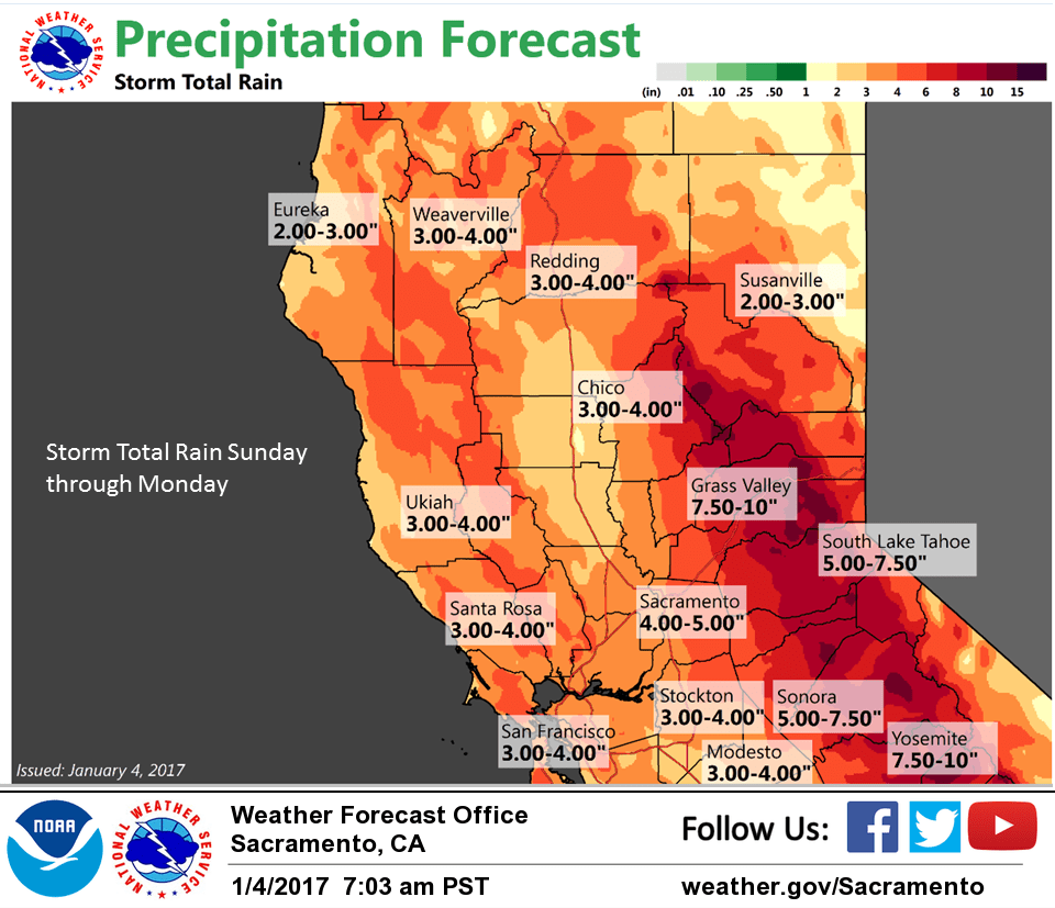
Extended discussion (Sunday through Wednesday)
Models in relatively good agreement maintaining the very wet pattern across the region into next week as the deep trough is maintained just off the PacNW coast with strong westerly flow beneath it continuing to usher strong storms into NorCal about every other day with heavy precipitation and gusty winds. Major winter weather issues expected over the mountains with potential for increasing flood issues as well. Stay tuned.