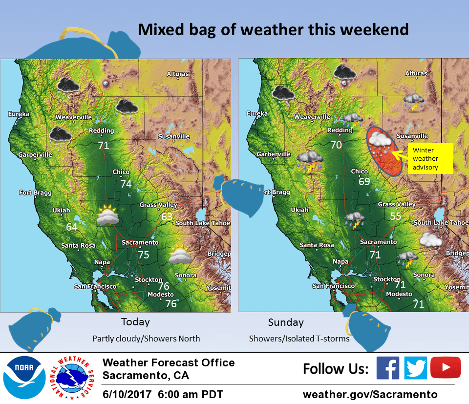
June 10, 2017 – A few showers mainly over the mountains today. Cooler system Saturday night into Sunday will bring showers, possible thunderstorms, and light mountain snow. Dry and warmer next week.
Discussion
Forecast area currently under dry conditions as it sits between shortwaves rotating around the low now centered off the northern Oregon coast. One of these shortwaves is now moving on to the north coast bringing showers there and these showers are likely to rotate through NorCal today bringing a threat of showers to the northern mountains and northern Sacramento valley. The remainder of the forecast area will likely remain dry today as the low center digs to the southeast. The low will however usher in cooler air to the entire CWA so daytime highs today are likely to come in several degrees below Friday’s readings.
Upper low center continues to drop southward tonight reaching northern California by Sunday morning and into northeast California by afternoon. Cold upper level air for this time of year will bring instability over the north state. Stability progs showing moderately unstable conditions over nearly the entire forecast area. Showers are likely most NorCal areas with a chance of thunderstorms as well.
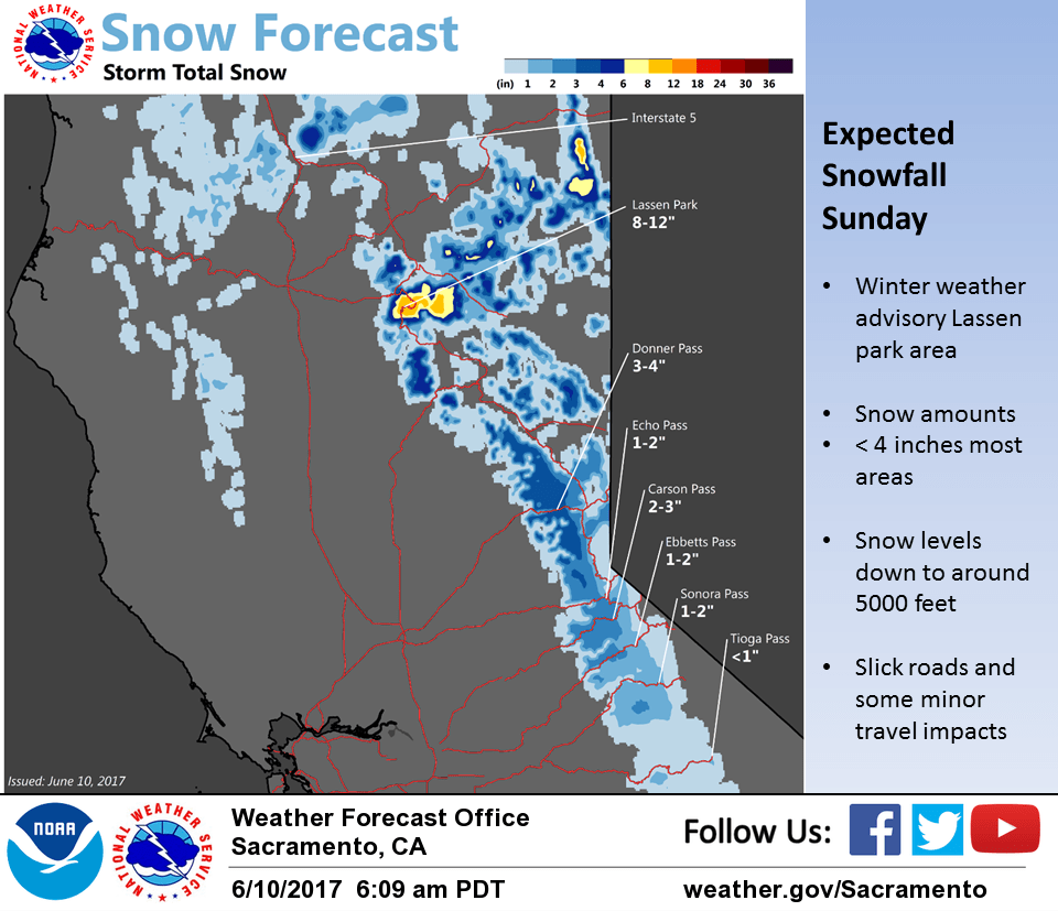
Precipitation amounts are expected to be mainly light but orographics over the Sierra will bring more precipitation there. Snow levels in the cold airmass will be quite low for this time of year down to around 5000 feet or below pass levels. As mentioned, precip will be mainly light but heavier showers could bring a little more. Several inches of new snow will be possible over the Lassen area so will leave the winter weather advisory for this area up for now. Elsewhere, only an inch or two of snowfall is expected. Cold airmass will bring down daytime temperatures even farther with the valley only making the lower 70s or as much as 15 to 20 degrees below normal.
Upper low moves into the Great Basin on Monday. Wrap around moisture could bring a few showers over the Sierra but the remainder of the forecast area will be dry. Daytime highs will warm several degrees but still come in well below normal. Dry conditions expected Tuesday with temperatures warming to near normal as flat high pressure sets up over the west coast.
Extended discussion (Wednesday through Saturday)
Models gradually increase heights over Interior NorCal Wednesday into Saturday. This will result in dry weather with a warming trend. High temperatures midweek expected to be near to slightly above normal but by the weekend, triple digit heat possible in the Central Valley. Areas of breezy northerly wind possible over Interior NorCal Friday into the weekend.