February 18, 2026 – A brief break in widespread precipitation today will be followed by the next wave of moderate to heavy precipitation this evening through Thursday. Winter Storm Warning continues through 10 PM Thursday.
A Winter Storm Warning has been issued for the foothills and mountains and all of Shasta County now through Thursday 10 PM. Expect major travel impacts from heavy snow, and mountain travel is highly discouraged during this time!
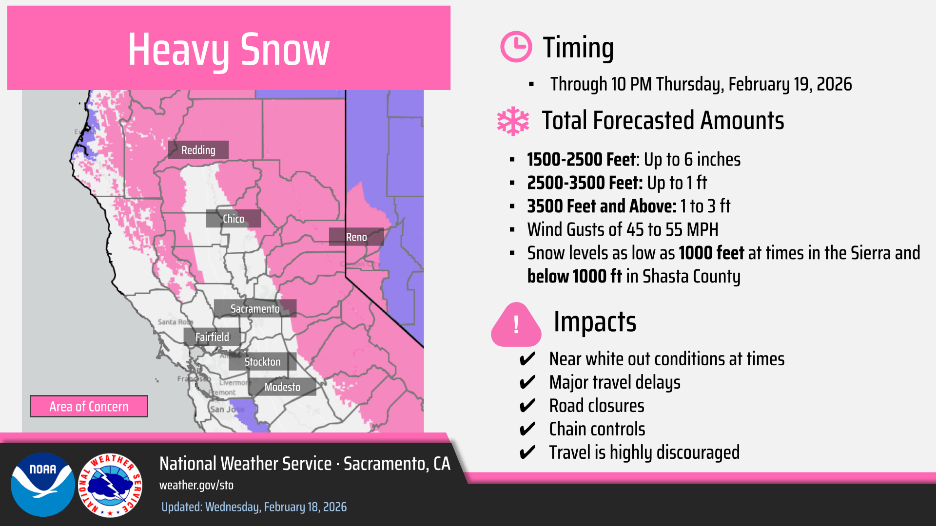
Significant low elevation snow will lead to dangerous travel conditions and icy or snow-covered roads. A look at the forecast snow totals for today through Thursday. Heavy mountain snow with snow levels down to 1000 feet at times.

Cold morning temperatures Friday and Saturday with lows near to below freezing. Cold temperatures will impact the unhoused and those without adequate heating. Sensitive plants left outdoors may be damaged or killed. Cold overnight temperatures could threaten pets and plants.

Cold AM temperatures and lingering snow showers early Friday with drier weather through Saturday. Snow levels rise over the weekend and into next week to around 4000-5500 feet.
Warmer storm system brings additional moderate to heavy rain/mountain snow and gusty winds Sunday into next week. *Snow Levels above 4000 ft expected late weekend-next week