September 13, 2017 – Showers and thunderstorms into mid-week. Cool down begins today and continues into Thursday.
Discussion
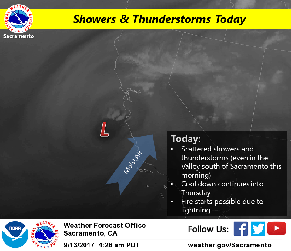
Upper low now just to the southwest of Monterey Bay. Thunderstorms have been firing early this morning around the low center just offshore, and across the northern San Joaquin Valley and Sierra to the northeast of the low. Frequent lightning has been occurring with the storms to the south of Sacramento.
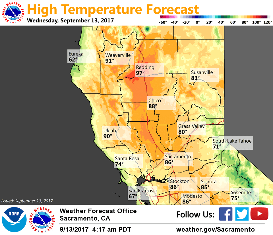
Temperatures are finally beginning to cool down across the area as onshore flow picks up and synoptic cooling is realized. Current temperatures are running around 3-10 degrees cooler compared to 24 hours ago and range rom the mid 40s in the mountain valleys to the 60s to mid 70s in the Central Valley.
The thunderstorm threat will continue from about the Sacramento region southward this morning as the upper low tracks onshore into central California. Forecast soundings indicate healthy amounts of elevated instability (500-1000 j/kg) across the northern San Joaquin Valley this morning, so vigorous storms likely to continue into the morning with lots of lightning, brief heavy rain and gusty winds, and even some small hail.
By this afternoon, the focus of deep convection likely to return to the mountains as favorable lift leaves the valley. The low will shift east tonight as a trough moves into the Pacific Northwest. This will bring stronger synoptic cooling later in the week along with pushing the deeper moisture and instability out of the region, but the mountains will continue to see a chance for showers and thunderstorms through Thursday. The coolest day of the week should be Thursday, with temperatures expected to be 6-12 degrees below average. Dry weather is expected late this week.
Extended discussion (Sunday through Wednesday)
Dry weather with near-normal temperatures on Sunday. However, an upper level trough moves into the Pacific NW and northern CA Monday into Wednesday. Models indicate that best chances for precipitation for our CWA will be across Shasta County and over the Sierra. Daytime highs will be on a gradual cooling trend as the trough moves inland. Tuesday looks to be the coolest day with max temperatures ranging 8-14 degrees below average.